
|





|
Whitehorse communities and street names
An Explorer's Guide to Whitehorse, Yukon
Dateline: May 2, 2024. Last update: October 1, 2025.
Whitehorse is divided into 37 communities, which have a total of 459 streets as of April 27, 2023. The lists below are complete as of that date. The City's Municipal Addressing and Naming Policy states:
Although the naming of streets is a seemingly simple task, there are issues to consider. Street and subdivision names may simply be labels for identification purposes. Additionally, they can be used as part of a system to facilitate finding a particular location. They can also provide a sense of identity to neighbourhoods. A similar purpose can be served by the names of parks and recreation areas and City owned buildings and facilities.
Street names in italics denote streets that exists in more than one neighbourhood.
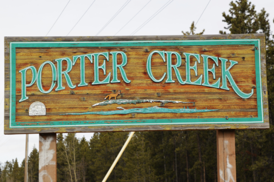
Most of the heavy sand-blasted community signs seen below were created by the late John Layman (1956-2024).
Geographic.org links each street name to their interactive Streetview and Google Maps.
Airport Groundside |
Arkell |
Canyon Crescent |
Copper Ridge |
Cowley Creek |
Crestview |
Downtown |
Eagle's Eye |
Forestview |
Fox Haven |
Granger |
Hidden Valley |
Hillcrest |
Ingram |
Kopper King Area |
Kulan Industrial |
Logan |
McCrae |
McIntyre |
MacPherson |
Marwell |
Mary Lake |
Mount Sima Industrial |
Pineridge |
Porter Creek |
Range Point |
Raven's Ridge |
Riverdale |
Spruce Hill |
Takhini |
Taylor Industrial |
Valleyview |
Whistle Bend |
Whitehorse Copper |
Wolf Creek |
Yukon Gardens |
Other Areas
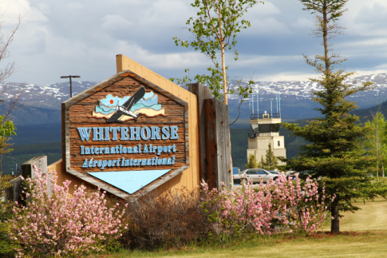
Airport
Erik Nielsen Whitehorse International Airport was renamed in honour of Erik Nielsen, the Yukon's Member of Parliament from 1957 until 1987, on December 15, 2008.
Theme: Aircraft.
- Avro Arrow Place: The Avro Canada CF-105 Arrow, which first flew on March 25, 1958, was the result of research that begin in 1953 to improve the company's CF-100 Canuck. The Arrow was a delta-winged interceptor aircraft which reached Mach 1.90 and 50,000 feet in altitude soon after flight testing began, but a long series of political issues resulted in cancellation of the program on February 20, 1959. Within two months, all aircraft, engines, production tooling and technical data were ordered scrapped.
- Barkley-Grow Crescent: The sleek aluminum 8-passenger Barkley-Grow T8P-1 first arrived in the Yukon in the Spring of 1940 with Yukon Southern Air Transport, owned by Grant McConachie, on a scheduled route between Edmonton and Whitehorse. Only 11 of these planes were built, of which 7 were sold to Canadian operators. On wheels and floats, Barkley-Grow aircraft served the Yukon for many years. Three survive in museums.
- Boeing Place: Over the years, Boeing aircraft have appeared in the Yukon in many forms, from the Model 247D bought by the British Yukon Navigation Company in 1940 to the large number of B-17 Flying Fortresses that were ferried through the territory during World War II, to today's fleet of Boeing 737s operated by Air North.
- Chipmunk Place: The very successful de Havilland Canada DHC-1 Chipmunk was designed as a primary training aircraft, and first flew on May 22, 1946. Chipmunks were produced in Great Britain and Portugal under licence from de Havilland Canada, and a total of 1,284 were built worldwide. Hundreds are still being flown by private pilots around the world.
- Condor Road: In August 1937, the British Yukon Navigation Company added a large 16-passenger Curtiss-Wright T-32-C Condor to their fleet. The twin-engine fabric biplane was so large that some runways had to be lengthened to accommodate it. This was the largest airliner being operated in Canada, and passengers got carried across the wilderness in comfort at 160 miles per hour.
- de Havilland Beaver Place: The de Havilland Canada DHC-2 Beaver, often referred to as the best bush plane ever built, first flew on August 16, 1947. A total of 1,657 were built before production ceased in 1967, and a large number are still in commercial, military, police, and civilian use, with turbine-engine conversions being very popular.
- Electra Crescent: Lockheed Electras have worked in the Yukon in three very different forms. The first commercial service between Whitehorse, Juneau, and Fairbanks was started in 1935 by Pacific Alaska Airlines, using a Lockheed 10A Electra. In 1942, Yukon Southern Air Transport took delivery of two Lockheed 14 Electras for a service from Whitehorse and Dawson to Vancouver and Edmonton. Today, we see Lockheed 188A Electras in service as aerial tankers to fight wildfires.
- Fairchild Place: A wide range of Fairchild aircraft worked commercially in the Yukon in the early days, including Models 24R, 24W, 71, several variants of the Model 72, and the particularly successful Model FC-2W2.
- Griffon Road: The Royal Canadian Air Force occasionally sends their CH-146 Griffon utility tactical-transport helicopters to the Yukon from the Cold Lake and Edmonton bases. The Griffon supports the tactical transportation of troops and materiel as well as search and rescue operations, surveillance and reconnaissance, training, casualty evacuations and counter-drug operations.
- Kingbird Road: In 1940, the British Yukon Navigation Company bought the only Curtiss-Wright D-3 Kingbird ever built. Designed in 1930 as an executive transport with seating for 5 passengers, it was powered by two 330 hp Whirlwind J-6-9 engines.
- Lodestar Lane: In 1942, Yukon Southern Air Transport bought two 18-passenger Lockheed Model 18 Lodestars, at the time one of the fastest airliners in the world. They were only in service a short time before being recalled by the factory for military use.
- Norseman Road: The Noorduyn Norseman, also known as the C-64 Norseman, first flew on November 14, 1935, and a total of 904 were built before production ceased in 1959. Similar to de Havilland's DHC-3 Otter, the Norseman has seen a fair bit of use in the Yukon - many are still flying in countries around the world.
- Otter Road: The de Havilland Canada DHC-3 Otter
- Pilgrim Place: The only Fairchild American Pilgrim 100-B to operate in the Yukon was a retired American Airlines plane originally brought in by North Canada Air Express in 1936, to run their Atlin-Juneau service.
- Tri-Motor Way: The famous 3-engined Ford Trimotor first flew on June 11, 1926, and eight years later one of them became the second aircraft purchased by the British Yukon Navigation Company. Both it and another Trimotor were eventually bulldozed into the aircraft junk pit at the Whitehorse airport.
- Zenith Place: The Zenith Aircraft Company of Mexico, Missouri, manufactures the Zenair line of kit aircraft.
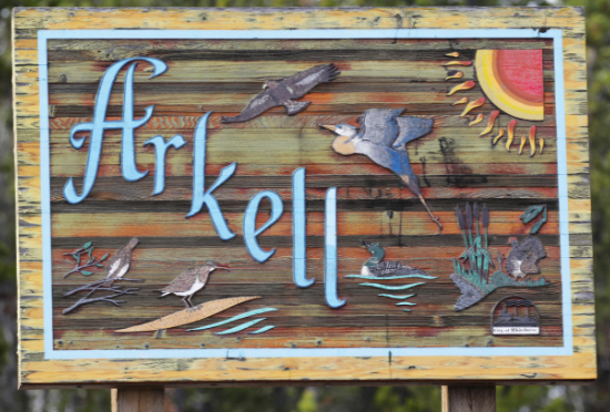
Arkell
Arkell was named for Mount Arkell, just west of Whitehorse. It was named for W. J. Arkell, sponsor of the Frank Leslie Illustrated Newspaper expedition into the Yukon in 1890.
Theme: Yukon birds.
- Eagle Place: Both the Bald eagle (Haliaeetus leucocephalus) and Golden eagle (Aquila chrysaetos) are found in the Yukon, with bald eagles being a fairly common sight in the Whitehorse area. Two bald eagle nests at opposite edges of downtown are popular attractions.
- Falcon Drive The Gyrfalcon (Falco rusticolus) and Peregrine falcon (Falco peregrinus) are both found in the Yukon.
- Grouse Crescent: Four species of grouse are found in the Yukon - the Ruffed grouse (Bonasa umbellus), Spruce grouse (Canachites canadensis), Dusky grouse (Dendragapus obscurus), and Sharp-tailed grouse (Tympanuchus phasianellus).
- Hamilton Boulevard: Hamilton Boulevard was named for William G. "Bill" Hamilton, who arrived in the Yukon in 1940 as a Canadian Bank of Commerce employee. In 1947 he went to work on the BYN riverboats and eventually became Superintendent of the company's River Division. Among many other activities, he was a Whitehorse alderman from 1950-1954.
- Heron Drive: The Great blue heron (Ardea herodias) is occasionally seen in the southern Yukon during migration.
- Loon Road: The Common loon (Gavia immer) is the loon species most frequently seen and heard on Yukon lakes and rivers, but three other species also visit - the Red-throated loon (Gavia stellata), Pacific loon (Gavia pacifica), and Yellow-billed loon (Gavia adamsii).
- Ptarmigan Place: Three species of ptarmigan are found in the Yukon; Rock ptarmigan (Lagopus muta), Willow ptarmigan (Lagopus lagopus), and White-tailed ptarmigan (Lagopus leucura).
- Sandpiper Drive: The Spotted Sandpiper (Actitis macularius), frequently spotted along riverbanks and lakes, is the most common of the sandpipers seen in the Yukon during migration.
Canyon Crescent
Canyon Crescent does not have a community sign.
- Canyon Crescent: Canyon Crescent was named for its proximity to Miles Canyon on the Yukon River.

Copper Ridge
There are a total of 191 lots in Copper Ridge. They were sold in three phases, the first 40 lots selling by lottery on May 9, 1995.
Theme: Minerals and rocks, mines, bears
- Adit Lane: In mining terminology, an adit is a horizontal passage from the surface, with only one entrance. If it goes right through the mountain and has two entrances, it is called a tunnel.
- Agate Court: Agaten, consisting of chalcedony and quartz as its primary components, is common in the Yukon. It comes in a wide variety of colors and is often used in jewelry. It is an important stone in spiritual practice, believed to cleanse and stabilise the aura, eliminating and transforming negativity and enhancing mental function.
- Amethyst Trail: Amethyst is a semiprecious violet crystalline quartz that is often used in both faceted and polished jewelry. It is an important stone in spiritual practice, believed to promote inner peace and healing, and positive transformation.
- Aquamarine Place: Aquamarine is a pale-blue to light-green variety of beryl, often used in both faceted and polished jewelry. Historically, aquamarine was a stone of courage, and was carried by warriors to guard against injury in battle.
- Beryl Place: Beryl is a source of beryllium, used in alloys to strengthen other metals, and various color varieties of the mineral are among the world's most popular gemstones.
- Black Bear Lane: Black Bear Lane was named either for the black bear (Ursus americanus), or for the Black Cub mineral claim in the southern part of the Whitehorse Copper Belt, staked in 1899.
- Carlisle Place: Carlisle Place was named for the Carlisle Mine, located along McIntyre Creek at what is now the edge of the Raven's Ridge subdivision. The property property first appeared in the newspaper in 1902 and by 1906 it was shipping ore.
- Carnelian Court: Carnelian, a variety of the silica mineral chalcedony colored a brownish-red by iron oxide, is commonly used as a semi-precious gemstone. In spiritual practice, carnelian is believed to promote confidence, energy flow, and passion.
- Diamond Way: Diamonds are a rare, naturally occurring mineral composed entirely of carbon. The hardest known natural substance, diamonds have many industrial uses, but they also have special optical properties which make them the world's most popular gemstone.
- Drift Drive: In mining terminology, a drift is a horizontal passage underground which follows the vein of ore. A drift is distinguished from a crosscut which intersects the vein, or a level or gallery, which may do either.
- Emerald Trail: Emeralds are a variety of beryl coloured green or bluish green by trace amounts of chromium or sometimes vanadium. Emeralds are most commonly used in faceted jewelry. The gem's popularity goes far back into history - Cleopatra valued emeralds as sacred symbols of fertility and immortality.
- Falcon Drive The Gyrfalcon (Falco rusticolus) and Peregrine falcon (Falco peregrinus) are both found in the Yukon.
- Garnet Crescent: Garnets are a set of closely related minerals that form a group, resulting in crystalline gemstones in almost every colour, though red garnets are the best known. In spiritual practice, garnets are believed to help counter melancholy and to stir the heart to great deeds.
- Gem Place: A gem (gemstone) is a precious or sometimes semiprecious stone cut and polished for ornament, but the term is also used to desribe a highly prized or well-beloved person or object.
- Grafter Place: The Grafter Mine was the second most productive after the Pueblo in the Copper Belt's early years and was worked sporadically until at least 1917.
- Grizzly Circle: Grizzly Circle was named either for the grizzly bear (Ursus arctos horribilis), or for the Grizzly mineral claim in the Whitehorse Copper Belt.
- Hamilton Boulevard: Hamilton Boulevard was named for William G. "Bill" Hamilton, who arrived in the Yukon in 1940 as a Canadian Bank of Commerce employee. In 1947 he went to work on the BYN riverboats and eventually became Superintendent of the company's River Division. Among many other activities, he was a Whitehorse alderman from 1950-1954.
- Iron Horse Drive: Iron Horse Drive was named for the Iron Horse mineral claim in the Whitehorse Copper Belt, surveyed as Lot 145 Group 5 in about 1908.
- Keewenaw Drive: The Keewenaw copper property was staked in 1899, but no work was done until 1907, and then only some shallow testing. Open pit mining was begun on the property in 1969 but the ore was low grade and was terminated in 1971
- Kodiak Place: Kodiak bears are a unique subspecies of the brown or grizzly bear (Ursus arctos middendorffi). With a population of about 3,500, they live exclusively on the islands in the Kodiak Archipelago and have been isolated from other bears for about 12,000 years.
- Lazulite Drive: Lazulite is an aluminum magnesium iron phosphate that forms as masses of crystals. Its deep blue colour makes it popular as a gemstone - its name comes from a Arabic word meaning "heaven."
- Moonstone Lane: Moonstone , also known as hecatolite, is a soft, milky-coloured stone in the feldspar group of minerals. The apparent magical glow of moonstone make sit a popular gemstone. In spiritual practice, moonstone is believed to harvest the moon's energy, promoting passive and relaxing energy and positive well-being.
- North Star Drive: Little is known about the North Star copper property except that two small exploration pits were dug there in 1907. It is located near the northeast base of Mount Sima ski area.
- Olivine Place: Olivine is a green rock-forming mineral found mainly in dark-colored igneous rocks and thought to be the most abundant mineral in the Earth's mantle. It is commonly seen exposed in the Copper Belt.
- Peridot Crescent: Peridot, sometimes called chrysolite, is a deep yellowish-green transparent variety of olivine - it is one of the few gemstones that occurs in only one colour. In spiritual practice, peridot is associated with happiness, abundance and light.
- Pueblo Court: The Pueblo Mine was one of the most productive mines in the early days of the Copper Belt. It was staked by H. E. Porter on July 7, 1899, and development started right away. The mine was located near what ias now the junction of the Fish Lake Road and the Copper Haul Road.
- Pueblo Crescent: On March 21, 1917, a cave-in at the mine trapped nine miners. Three miners were rescued, but six were never found. A memorial plaque about the tragedy was mounted on a boulder at the junction of the Fish Lake Road and the Copper Haul Road in 2000.
- Ruby Lane: Rubies are a pinkish red to blood-red gemstone, a variety of the mineral corundum. Ruby is one of the most popular traditional jewelry gems and today can command the highest prices of any coloured gemstone. Spiritually, red is the colour of self-confidence built on fearlessness, and rubies are the stone of the heart, promoting happiness and a passion for life.
- Sapphire Lane: Although sapphire is generally known as a blue gemstone, it comes in a wide range of colours. Sapphire is a precious gemstone, very popular as facetted jewelry. In spiritual practice, sapphire is one of the most important stones, a symbol of power and strength, but also of kindness and wise judgment.
- Spinel Place: Spinel is technically a large group of very dark minerals which includes gahnite, hercynite, ceylonite, picotite, and galaxite. Spinel as a gemstone is available in many colours from very light pastels to black.
- Stope Way: In mining terminology, a stope is an underground cavity made by removing ore from surrounding rock.
- Tigereye Crescent: Also known as Tiger's eye, tigereye is a semiprecious quartz gem displaying chatoyancy, a vertical luminescent band like that of a cat's eye. In spiritual practice, tigereye is believed to promote self-confidence and inner strength.
- Topaz Crescent: Topaz, though fairly rare as a mineral, is a fairly common and inexpensive gemstone that is found in a wide range of colours. It can be found in huge and flawless crystals, which can be faceted into giant gemstones which can weigh thousands of carats.
- Turquoise Court: Turquoise is an opaque mineral that occurs in beautiful shades of blue, bluish green, green, and yellowish green, which has been treasured as a gemstone for thousands of years. In spiritual practice, turquoise is believed to bring luck, peace, and protection.
- Valerie Crescent: This mining property in the Whitehorse Copper Belt was staked in 1899 and began shipping ore in 1903.
- Winze Lane: In mining terminology, a winze is a vertical or steeply inclined passageway between two levels in a mine.
- Winze Place: In mining terminology, a winze is a vertical or steeply inclined passageway between two levels in a mine.
- Zircon Lane: A gemstone belonging to the group of nesosilicates and a source of the metal zirconium. In spiritual practice, zircon is believed to clear negative energy and have a protective aura.
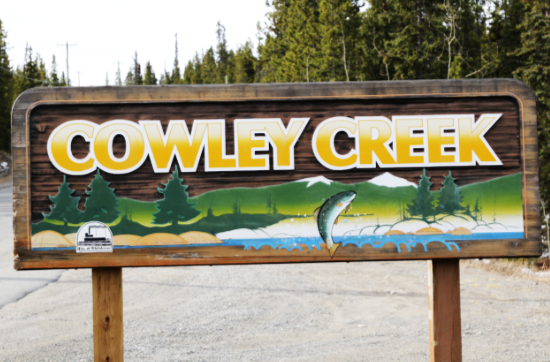
Cowley Creek
Cowley Creek was named for Cowley station on the White Pass & Yukon Route railway at MP 100.6 - it was named for Cowley Lambert, a director of the company in England.
Theme: Fish.
- Chinook Lane: Chinook salmon (Oncorhynchus tshawytscha) are the largest of the Pacific salmon. In Alaska they are called King Salmon or Kings, and that name is catching on in the Yukon.
- Chum Place: Chum salmon (Oncorhynchus keta), also known as dog salmon, is the second largest species of Pacific salmon.
- Coho Trail: Coho salmon (Oncorhynchus kisutch) are also known as Silver salmon or Silvers.
- Dolly Varden Drive: Dolly Varden (Salvelinus malma) are fresh-water fish and belong to the family of salmon- and trout-like fish.
- Grayling Place: Arctic grayling (Thymallus arcticus) is a species of freshwater fish in the salmon family, notable for their colourful body markings and very large dorsal fin.
- Kokanee Place: Kokanee Salmon (Oncorhynchus nerka) are the landlocked version of Sockeye salmon and nearly identical except for their smaller size.
- Pike Place: The northern pike (Esox lucius) is a species of fresh-water carnivorous fish. They are apex predators whose diet mainly consists of fish, but may include frogs, birds, mice, and many other creatures.
- Salmon Trail: There are five species of salt-water Pacific salmon, and two fresh-water species.
- Sockeye Place: Sockeye salmon (Oncorhynchus nerka) are one of the smaller species of Pacific salmon. They turn red in during spawning, and are also known as red salmon.
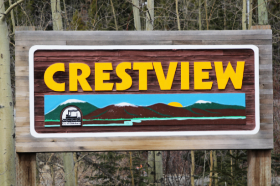
Crestview
Theme: Yukon Lakes.
- Askin Place: Askin Lake, at an elevation of 1,291 metres, is south of Faro, between Twin Mountain and Mount Cook. Located at 61° 56' 3" N., 133° 12' 53" W.
- Azure Road: Azure Lake, at an elevation of 1861 metres, is in Tombstone Territorial Park, high above and to the north of the Tombstone River. Located at 64° 28' 45" N., 138° 35' 40" W.
- Bryde Place: Bryde Lake, at an elevation of 1124 metres, is at the south foot of Mount Bryde, west of Teslin. Located at 60° 3' 51" N., 133° 12' 21" W.
- Cache Place: Cache Lake, at an elevation of 1523 metres, is in Kluane National Park; it drains into the Duke River. Located at 61° 12' 33" N., 139° 3' 45" W.
- Crag Road: Crag Lake, at an elevation of 877 metres, is along the Tagish Road between Carcross and Tagish. Located at 60° 14' 17" N., 134° 30' 29" W.
- Dezadeash Road: Dezadeash Lake, at an elevation of 720 metres, is along the Haines Highway, accessed from the Dezadeash Lake Campground at Km 195.7. Located at 60° 27' 55" N., 136° 59' 57" W.
- Kathleen Road: Kathleen Lake, at an elevation of 754 metres, is along the Haines Highway at Km 219.7, in Kluane National Park. Located at 60° 35' 36" N., 137° 15' 37" W.
- Klukshu Avenue: Klukshu Lake, at an elevation of 788 metres, is immediately north of the First Nations village of Klukshu, which is on a side road off the Haines Highway at Km 183.2. Located at 60° 18' 53" N., 137° 0' 37" W.
- Kusawa Road: Kusawa Lake, at an elevation of 671 metres, is west of Whitehorse, 23 km south of the Alaska Highway at Km 1489.2, where the Kusawa Lake Road begins. Located at 60° 21' 23" N., 136° 20' 26" W.
- MacKenzie Court: the only street name that is not a lake runs into a housing development on what was the Mackenzie Trailer Court until about 2012.
- Minto Road: Minto Lake, at an elevation of 885 metres, is northwest of Mayo. 63° 41' 11" N., 136° 9' 53" W.
- Rainbow Road: Emerald Lake, north of Carcross, used to be called Rainbow Lake. Located at 60° 16' N., 134° 45' 2" W., it sits at an elevation of 746 metres.
- Squanga Avenue: Squanga Lake, at an elevation of 864 metres, is along the Alaska Highway east of Whitehorse, accessed from the Squanga Lake Campground at Km 1315.9. Located at 60° 26' 48" N., 133° 36' 8" W.
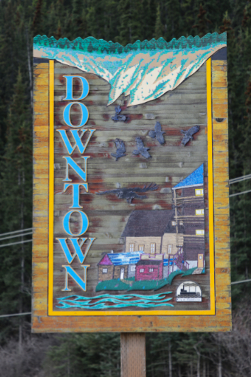
Downtown
Primary theme: Yukon pioneers.
- 2nd Avenue: This is the main through-street in the downtown area, running from Robert Service Way to Two Mile Hill Road. The former 1st Avenue was renamed Front Street in 2013.
- 3rd Avenue
- 4th Avenue: This is the secondary through-street in the downtown area. Northbound, it turns into Two Mile Hill Road where 2nd Avenue curves around to meet it.
- 5th Avenue
- 6th Avenue
- 7th Avenue
- 8th Avenue: Streets get shorter as the curve of the escarpment (the "clay cliffs") is approached - 8th Avenue is only seven blocks long. The name of 9th Avenue was removed when the homes were removed in the late 1950s due to instability of the escarpment slopes.
- Alexander Street: Alexander Street was named for Field Marshall Viscount Alexander, who was Canada's Governor General from 1945 to 1952. When he and his wife visited Whitehorse in 1947, a new housing area was being developed, and Alexander Street had just been built.
- Baxter Street: One of the shortest streets in the downtown area, only two blocks long, was named for Charlie Baxter, an American who came north in the 1920s and built a place called Baxter's ranch here. He rented horses for hunting parties, surveyors, and sometimes locals who wanted to go for a wander.
- Black Street: Black Street was named for George and Martha Black, who both served as the Yukon Territory's Member of Parliament. George was also Speaker of the House from 1930-1935. They had moved from Dawson to Whitehorse in 1946 and left their mark on both communities.
- Chilkoot Way: In December 2001, a new street running between Two Mile Hill and Quartz Road, built to access the new Wal-Mart store and the proposed Chilkoot Shopping Centre, was named Chilkoot Way. The Chilkoot Trail was the most famous of the routes into the Yukon Territory during the Klondike Gold Rush.
- Cook Street: Cook Street was named for bush pilot and fur trader Les Cook. He once operated a trading post on Sheldon Lake. When the American military began surveying the route for the Alaska Highway, Les Cook was hired to conduct aerial reconnaissance. On December 4, 1942, as Cook took off from the airport, the plane plunged to the ground on Front Street and Les Cook, Ken McLean, and Don Dickson were killed. In 1944, the American military awarded Cook the U.S. Air Medal for several mercy flights he had made for them.
- Drury Street: Drury Street was named for William "Bill" Drury. He and Isaac Taylor met in Atlin in 1898, when both were heading north to see what kind of business opportunities were available. Taylor & Drury eventually operated 13 department stores throughout the territory, supplying many of them with their own riverboats.
- Elliott Street: Elliott Street is named for Frank C. Elliott, who was a lawyer for the White Pass & Yukon Route in their Chicago office in 1899, and was President of the company from 1911 until 1928.
- Front Street: In 2013, the name of the street nearest the Yukon River was changed from First Avenue (or 1st Avenue) to Front Street. While the street has legally been First Avenue since it was first surveyed, in practice, Front Street and First Avenue have both been used, and that continues to this day (2023).
- Hanson Street: Hanson Street was named for Edwin Hanson, a White Pass & Yukon Route company director in England in the early days.
- Hawkins Street: Hawkins Street was named for E. C. Hawkins, who was the Chief Engineer in charge of the construction of the White Pass & Yukon Route railway, and became General Manager of the White Pass company when it began service in 1900.
- Hoge Street: Hoge Street was named for Brigadier General William Hoge of the United States Army. In February 1942 he was put in charge of the construction of the Alaska Highway. That summer the project was split in half and Hoge was placed in charge of the northern section, with headquarters in Whitehorse.
- Jarvis Street Jarvis Street was named for Inspector A. M. Jarvis of the North West Mounted Police, who was stationed at the Dalton Post customs office in 1898.
- Jeckell Street: Jeckell Street was named for George Allan Jeckell, who came to the Yukon in 1902 to teach in Dawson City. He was Comptroller from June 30, 1932 to December 2, 1936, then the name of the position was changed to Controller and he remained in it until September 20, 1947.
- Keish Street: Keish Street, only one block long, was named for Keish, who became the first First Nations person to become successful in the white man's world in the Yukon. He was born near Lake Bennett in 1855, in the Dakl'aweidi clan. He became known as Skookum Jim Mason during his days packing across the Chilkoot Trail, and was a member of the party that discovered the Klondike gold in 1896.
- Lambert Street: Lambert Street was named for Cowley Lambert, a director of the White Pass & Yukon Route company in England.
- Lowe Street: Lowe Street was named for businessman Robert Lowe. He ran a wide variety of businesses, and became the Speaker of the first wholly elected Territorial Council in 1909.
- Main Street: Despite concerns that malls could kill downtown Whitehorse as it has so many downtowns, Main Street is still the heart of Whitehorse, with banking, three hotels, and a wide variety of stores and services.
- Ogilvie Street: Ogilvie Street was named for the Yukon's first commissioner, William Ogilvie. He had first come to the Yukon in 1887 as a Dominion Land Surveyor. In 1896, he surveyed the new townsite called Dawson City.
- Quartz Road: Quartz Road is the main access road from downtown to the Marwell industrial area. Quartz is a hard, crystalline mineral composed of silica. It's commonly used for decorative purposes including jewelry, but has many industrial uses as well.
- Ray Street: Ray Street is named for Irwin Ray, a long time Yukon prospector who mined around the Mayo district in the '30s and '40s. With the expansion of Whitehorse, Ray, and his mining partner Ed Barker, bought a piece of land and started Tourist Services, which included a bar, motel rooms, a garage and a restaurant.
- Robert Service Way: Robert Service Way, which was initially called the South Access, was named for poet Robert W. Service in 1995. We have posted a very detailed history of Robert Service Way.
- Rogers Street: Rogers Street was named for Clifford J. Rogers, who went to work for the White Pass & Yukon Route as a boy in 1900, and became President of the company from 1940 to 1957. The first White Pass container ship, launched in 1955 to run between Skagway and Vancouver, was also named after him.
- Steele Street: Steele Street was named for Samuel Benfield Steele, who was an original member of the North West Mounted Police when it was formed in 1873. In January of 1898, he was ordered by the federal government to establish a customs post and police presence atop the Chilkoot and White Passes. Later that year, Steele moved to Dawson and is credited with setting up the policing and administrative systems which turned Dawson into a relatively peaceful and well-run district.
- Strickland Street: Strickland Street was named for D'Arcy Strickland, who came to the Yukon as an Inspector with the North West Mounted Police in 1894 and helped build Fort Constantine downriver from Dawson. Later he commanded the NWMP post at the summit of the White Pass, enforcing the strict rules for entering the Yukon on their way to the Klondike.
- Taylor Street: Taylor Street was named for Isaac Taylor. He and William "Bill" Drury met in Atlin in 1898, when both were heading north to see what kind of business opportunities were available. Taylor & Drury eventually operated 13 department stores throughout the territory, supplying many of them with their own riverboats.
- Waterfront Place: Waterfront Place is a short L-shaped road named in 2001. It was built by the developers of the Waterfront Place condominiums.
- Wheeler Street: Wheeler Street was named for Herbert Wheeler, the third President of the White Pass & Yukon Route, who managed the company through the difficult Depression years of the "dirty '30s." In the late 1950s, homes along 9th Avenue were removed due to instability of the escarpment slopes, and the two blocks of the street that remain are considered to be part of Wheeler Street.
- Wood Street: Wood Street was named for Zachary Taylor Wood. He was appointed an inspector in the North West Mounted Police in 1885, and in 1897 was transferred to the Yukon. He assumed command of the NWMP in the Yukon on April 18, 1900, became Assistant Commissioner in 1902, and remained in the territory until 1910.
Eagle's Eye
Eagle's Eye was developed in 2010 by the Icy Waters fish production company, with the name reflecting a common bird in the area.
Eagle's Eye does not have a community sign.
- Watershed Lane: Located along the Fish Lake Road between Pumphouse Lake and Porter Creek (the creek).
Forestview
Forestview does not have a community sign.
- Cousins Airstrip Road: The road that connects the Alaska Highway to Cousins Airstrip has a few acreage residential lots along it.
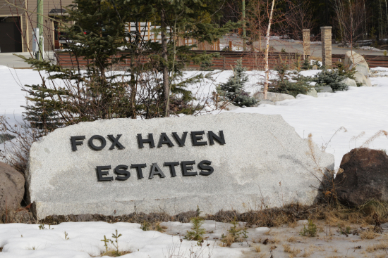
Fox Haven
The 27-lot Fox Haven country residential subdivision was planned in 2006 by Jeff Luehmann, operator of the Meadow Lakes Golf and Country Club after deciding that adding another 9 holes to the golf course wasn't viable.
- Alusru Way: There are two possibilities for this name so far. As a first name, Alusru is meant to denote a sociable person who appreciates the beauties of nature and the refinements of life, and is moved by music and the arts. We have also heard that Alusru is the first name of the developer's mother, Ursula, spelled backards.

Granger
Granger was named for Mount Granger, located to the southwest, at the head of Fish Lake. Mount Granger was named for William P. Grainger (note the correct spelling), who arrived in the Yukon in 1895 and four years later was one of the first the work a property in the Whitehorse Copper Belt. He died in a mining accident there in 1907. First developed in the late 1970s when a boom was expected during construction of the Alaska Highway gas pipeline (which never happened), the first 44 lots of the 272 lots went on sale in November 1988.
Theme: Yukon Council members and other pioneers.
- Bowen Place: Bowen Place was named for the Reverend Richard John Bowen, an Anglican minister who built a log church at Dawson in 1897, then in 1900 built what is now The Old Log Church in Whitehorse.
- Gillis Place: Gillis Place was named for Dr. Alexander J. Gillis, member of the Yukon Territorial Council from 1912 until 1915.
- Granger Drive: Granger Drive was named for William P. Grainger (note the correct spelling), who arrived in the Yukon in 1895 and four years later was one of the first the work a property in the Whitehorse Copper Belt. He died in a ming accident there in 1907.
- Hamilton Boulevard: Hamilton Boulevard was named for William G. "Bill" Hamilton, who arrived in the Yukon in 1940 as a Canadian Bank of Commerce employee. In 1947 he went to work on the BYN riverboats and eventually became Superintendent of the company's River Division. Among many other activities, he was a Whitehorse alderman from 1950-1954.
- Hayes Crescent: Hayes Crescent was named for Charles C. Hayes, owner of the War Eagle Mine in its early years.
- Hayes Place: Hayes Place was named for Alexander R. Hayes, member of the Yukon Territorial Council from 1952 until 1958.
- Salter Place: Salter Place was named for Maxwell Charles Salter, member of the Yukon Territorial Council in 1917-1918.
- Tabor Crescent: Tabor Crescent was named for Charles William C. Tabor, member of the Yukon Territorial Council from 1912 until 1915.
- Thompson Road: Thompson Road was named for Dr. Alfred Thompson, member of the Yukon Territorial Council from 1903 until 1905.
- Turner Crescent: Turner Crescent was named for John Turner, member of the Yukon Territorial Council from 1915 until 1918.
- Williams Place: Williams Place was named for J. O. Williams, steamboat captain and mine owner.
- Williams Road: Williams Road was named for George N. Williams, member of the Yukon Territorial Council from 1912 until 1917.
- Wilson Drive: Wilson Drive was named for Arthur Wilson, member of the Yukon Territorial Council from 1900 until 1903.

Hidden Valley
The first 15 acreage lots in the Hidden Valley Subdivision were put on sale in December 1988 by land owner Wayne Klippert, with title available on July 1, 1989, once the access roads were completed. Another 8 lots were being planned by Dietmar Ordowski. The first streets were officially named in March 1991.
Primary Theme: Berries.
- Cloudberry Lane: The Cloudberry (Rubus chamaemorus) grows in bogs and moist forests. The berries look like raspberries but are salmon-coloured and taste quite sour or bitter.
- Couch Road: Couch Road is the main road that arcs through the subdivision. It was named after Orval and Helen Couch, who lived nearby on Strawberry Lane. They were Mr. & Mrs. Yukon for the 1992 Sourdough Rendezvous.
- Cranberry Place: There are two varieties of cranberry in the Yukon - Bog cranberry (Vaccinium oxycoccus) and Lingonberry (Vaccinium vitis-idaea). The berries stay on the plant year round.
- Loganberry Lane: The Loganberry (Rubus loganobaccus) was created in California by James Harvey Logan, who crossed a blackberry with a raspberry.
- Mossberry Lane: Mossberry is a common name for several plants, including the Crowberry (Empetrum nigrum).
- Roderick Place
- Soapberry Lane: The Soapberry (Shepherdia canadensis) got its name because they contain saponin, which lathers up like soap when the berries are crushed. They are an important food for both Grizzly and Black bears, and are used to make "Eskimo ice cream."
- Strawberry Lane: The tiny and very tasty Wild strawberry (Fragaria virginiana) is common in disturbed areas throughout the southern Yukon.
- Stehelin Drive: Stehelin Drive was constructed in 2017 to access six new acreage lots.
- Timothy Place: Native to Europe, timothy (Phleum pratense) is now widespread in North America including the southern Yukon. It is is commonly grown for hay in Alaska, and beyond cultivation is most often found in old fields, roadsides, home sites, and other disturbed areas.
Hillcrest
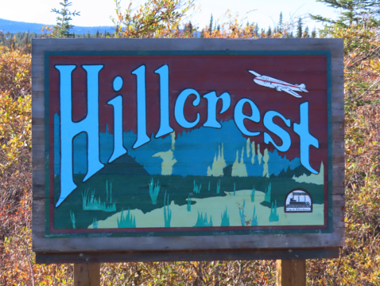
The first 50 homes in Hillcrest were built by the Royal Canadian Air Force starting in November 1948 - see our history of the Hillcrest area for much more information.
Theme: None apparent.
- Burns Road: Burns Road was named for the P. Burns & Company meat packers. Founded in Calgary by Patrick Burns in 1890, they came to the Yukon in 1898 - cattle were sent by boat from Vancouver, then driven inland, slaughtered and floated down the Yukon River to Dawson. The 1905 Burns Building is a significant heritage building in Whitehorse today.
- Chalet Crescent
- Dalton Trail: Dalton Trail was named for a historic trail by that name. In 1891, Jack Dalton began upgrading a historic First Nations trading route from Pyramid Harbor near Haines to Fort Selkirk on the Yukon. Although it never gained much popularity as a transportation route during the Klondike Gold Rush, it did become the best trail for driving cattle and reindeer to the interior.
- Hillcrest Drive
- Kluane Crescent: Kluane Crescent was named for the large Kluane Game Sanctuary that had been created in 1947 as Hillcrest was being planned. It became the foundation for Kluane National Park in 1972.
- Park Lane
- Roundel Road: Roundel Road was named for the round emblem that identifies Canadian aircraft of all three military branches. The RCAF roundel is a blue ring, surrounding a white area in the centre of which is the red maple leaf. It was adopted on July 5, 1940 - prior to that, the British roundel had been used.
- Summit Road
- Sunset Drive North
- Sunset Drive South
- Wasson Place: Wasson Place was named for pioneer pilot and aircraft mechanic Everett W. Wasson. He started working in the Yukon in 1928, for the Treadwell-Yukon Mining Company in Mayo. After five years there he moved to Northern Airways, then to the British Yukon Navigation Company until 1941.

Ingram
The Ingram subdivision, approved in August 2008, consists of single-family, townhouse, and multi-family lots on 13.1 hectares of land adjacent tom the Arkell subdivision. It was named after Mount Ingram.
Theme: Water birds.
- Goldeneye Place: Barrow's Goldeneye (Bucephala islandica), a stocky diving duck, can be found on waterbodies throughout much of the Yukon during spring migration.
- Goldeneye Street: A large portion of the world population of Barrow's Goldeneye (Bucephala islandica) breeds in the Yukon.
- Hamilton Boulevard: Hamilton Boulevard was named for William G. "Bill" Hamilton, who arrived in the Yukon in 1940 as a Canadian Bank of Commerce employee. In 1947 he went to work on the BYN riverboats and eventually became Superintendent of the company's River Division. Among many other activities, he was a Whitehorse alderman from 1950-1954.
- Mallard Way: The Mallard (Anas platyrhynchos) is one of the most successful species of ducks in the world, to the point that they are considered to be an invasive species in some regions.
- Pintail Place: The Northern pintail (Anas acuta), a medium-sized dabbling duck, is are found in shallow ponds or wetlands in the Yukon.
- Pintail Street: The Northern pintail (Anas acuta) is a hardy bird that breeds as far north as the Arctic coast, and winters as far north as Southeast Alaska.

Kopper King Area
Kopper King was named for the Copper King Mine in the Whitehorse Copper Belt.
Theme (both community and street): Mining.
- Prospector Road: Although fur traders were the first Europeans to come to what would become the Yukon Territory, it was prospectors whose activities brought the region to international fame for many years.
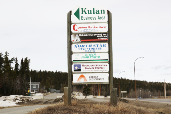
Kulan Industrial
Kulan Industrial was named after Al Kulan, a prospector who in 1953 discovered the large lead-zinc deposit that became the Faro Mine. He was murdered in Ross River in 1977. The Yukon Prospectors Association inducted Kulan into their Hall of Fame in 1988, and he was inducted into the Canadian Mining Hall of Fame in 2005.
Theme: Lakes
- Bennett Road: Lake Bennett, at an elevation of 660 metres, stretches from Bennett, BC, to Carcross, Yukon, at at 60° 04' 50" N., 134° 51' 51" W. The White Pass & Yukon Route railway runs along the east shore. The only road access is at Carcross.
- Chadburn Crescent: Chadburn Lake, at an elevation of 658 metres, is located just to the southeast of Whitehorse, at 60° 39' 8" N., 134° 57' 21" W. It is accessed via Chadburn Lake Road.
- Laberge Road: Lake Laberge, at an elevation of 628 metres, is a widening of the Yukon River downriver from Whitehorse, at 61° 13' 12" N., 135° 15' 2" W. It is fifty kilometres long and ranges from two to five kilometres wide. The ice stays late on the lake, and in the steamboat days many boats wintered at the foot of the lake (Lower Laberge) to get an earlier start, with freight brought from Whitehorse by horse or dog teams.
- Lindeman Road: Lindeman Lake, at an elevation of 669 metres, is on the Chilkoot Trail, at 59° 48' N., 135° 3' 22" W. It drains into Lindeman Creek, formerly known as One Mile River, then into Bennett Lake.

Logan
Logan was named for Mount Logan, the highest mountain in Canada at 5,959 metres. It was named after geologist Sir William Edmond Logan, founder of the Geological Survey of Canada.
Theme: Birds.
- Bluejay Way: The Bluejay is not a Yukon bird, but the blue-and-black Steller's jay (Cyanocitta stelleri) is a very popular visitor to the southern Yukon. The Steller's jay is part of the Corvidae family that includes more common Yukon birds like crows, ravens, Canada jays, and magpies.
- Falcon Drive The Gyrfalcon (Falco rusticolus) and Peregrine falcon (Falco peregrinus) are both found in the Yukon.
- Finch Crescent: Many species of finch are found in the Yukon, with Pine grosbeak (Pinicola enucleator) and Common redpoll (Acanthis flammea) being year-round residents.
- Magpie Road: The black-billed magpie (Pica hudsonia) is fairly commonly seen in Whitehorse during the summer.
- Nuthatch Place: The Red-breasted nuthatch (Sitta canadensis), sometimes mistkane for a chickadee, frequent the territory's spruce forests.
- Warbler Way: Many specie sof wood-warblers visit the Yukon, including the Tennessee warbler (Leiothlypis peregrina) and the (Yellow-rumped warbler
Setophaga coronata).
- Wren Place: Three species of wren including the Winter wren (Troglodytes hiemalis) are known to visit the Yukon, but sightings are rare.
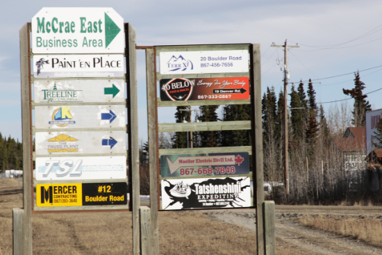
McCrae
Theme: White Pass & Yukon Route railway waypoints.
- Boulder Road: Boulder is located at Milepost (MP) 4.5 from the Skagway docks.
- Clifton Road: Clifton, where the granite cliffs arch over the rail line, is located at MP 8.5, at an elevation of 638 feet.
- Denver Road: Denver is located at MP 5.8, at an elevation of 498 feet. The Denver Glacier above that point has receded high up into the mountains, and is no longer visible from the rail line.
- Fraser Road: Fraser, now a Highways camp and Customs post as well as the site of a historic water tower for filling water tanks on steam locomotives, is located at MP 27.7, at an elevation of 2,764 feet.
- Glacier Road: Glacier is located at MP 14.0, at an elevation of 1,870 feet. Glacier Station was named for the Laughton Glacier which filled this valley with ice thousands of years ago. Today it too has receded so far up the valley that it is no longer visible from the rail line.
- Lansdowne Road: Landsdowne is located at MP 74.9.
- Lorne Road: Lorne is located at MP 79.4.
McIntyre
Infrastructure development of this First Nations residential area was started in 1979, and housing construction began in 1986 in order to relocate Kwanlin Dun members from the old village site at the north edge of Marwell. Initially called the McIntyre Neighbourhood (1979) and then the Mount McIntyre subdivision (1986), it was named for Mount McIntyre, which was named for John McIntyre, who staked the nearby Copper King mine in July 1898. In late November 1902, he and fellow mail carrier Joseph Abbey fell through the ice on a run from Atlin to Log Cabin and were drowned or frozen.
Theme: Yukon politicians.
- Boyd Crescent: Boyd Crescent was named for Bert Boyd. He and his family came to Whitehorse in 1947 and had an eclectic career, from chicken rancher to serving two terms on the Yukon Territorial Council and working on several government and society boards.
- Hamilton Boulevard: Hamilton Boulevard was named for William G. "Bill" Hamilton, who arrived in the Yukon in 1940 as a Canadian Bank of Commerce employee. In 1947 he went to work on the BYN riverboats and eventually became Superintendent of the company's River Division. Among many other activities, he was a Whitehorse alderman from 1950-1954.
- Hanna Crescent: Hanna Crescent was named for James A. "Jim" Hanna, who came to Whitehorse as an optometrist in 1949, and served three one-year terms as City councillor as well as working on the boards of several groups including the Kiwanis, Civic Centre Association, and Boy Scouts.
- Johnston Road: was named for Charles Henry Johnston, who built the original Regina Hotel in 1900, and represented Whitehorse on the Yukon Territorial Council from 1917 until 1920.
- Landreville Drive: Landreville Drive was named for Maxime "Max" Landreville, who came to the Yukon in 1895 as a miner and went on to serve three non-consecutive terms as a member of the Yukon Territorial Council.
- Light Crescent: Light Crescent was named for R. J. "Jim" Light, who served five one-year terms as an alderman on Whitehorse city council, from 1966 to 1970. He died in September 1970, and in October the Whitehorse Civic Arena was re-named the Jim Light Memorial Arena.
- Macaulay Road: Macaulay Road was named for Norman D. Macaulay, who built the first horse-drawn tramline around Miles Canyon and the rapids below in 1898, then built the White Horse Hotel in 1900.
- McCandless Crescent: McCandless Crescent was named for John Gilmore "Jack" McCandless, who came to Whitehorse in 1952 as a plastering contractor (McCandless & Graham Co.), was very active with the Lions Club, and served one term as a City alderman.
- McClennan Road: It is not clear who McClennan Road was named for - we have been unable to find anyone by that name who would quality. However, Donald McLennan was a member of the Yukon Territorial Council in 1914-1915.
- McClimon Crescent: McClimon Crescent was named for Sam McClimon, owner of the Whitehorse Theatre and a member of the first Whitehorse city council, elected in August 1950. He served two one-year terms.
- McCrimmon Crescent: was named for John F. McCrimmon, a member of the Yukon Territorial Council from 1915 until 1917.
- McIntyre Drive: McIntyre Drive, the main road through the subdivision, was named for John McIntyre, who staked the nearby Copper King mine in July 1898. In late November 1902, he and fellow mail carrier Joseph Abbey fell through the ice on a run from Atlin to Log Cabin and were drowned or frozen.
- McMillan Crescent: McMillan Crescent was named for Allen Angus McMillan, a member of the Yukon Territorial Council from 1917 until 1920.
- Murphy Road: Murphy Road was named for James William Murphy, a member of the Yukon Territorial Council from 1909 until 1912.
- O'Brien Place: O'Brien Place was the second street named for Thomas William O'Brien - see O'Brien Road below.
- O'Brien Road: O'Brien Road was named for Thomas William O'Brien, who came tom the Yukon as a miner in 1886 but soon went into business, among his best known being the Yukon Sun newspaper, O'Brien's Brewing and Malting, and the Klondike Mines Railway. He was also was the first president of the Yukon Order of Pioneers, and served one term as a member of the Yukon Territorial Council.
- Pringle Crescent Pringle Crescent was named for the Rev. John Pringle, who arrived in the Yukon as a missionary in 1897, served throughout the territory, and was a member of the Yukon Territorial Council from 1903 until 1905.
- Wylie Crescent: Wylie Crescent was named for N. V. K. "Vic" Wylie, who was an alderman on Whitehorse city council and 1958 and 1959, and mayor in 1960 and 1961.

MacPherson
Development of this country residential subdivision began in 1976, and the 55 lots, ranging from 1.8 to 5.2 acres, went on sale on August 12, 1977 - all were sold within 3 hours. The name of the subdivision and main road was said by Whitehorse council in October 1976 to honour two families. Herbie MacPherson was a pioneer merchant and druggists, and his son Stuart continued the family business up until the mid 1960s. Blacksmith John "Sandy" McPherson (the council report incorrectly used the spelling MacPherson) was in charge of the horses for White Pass in the days when there were 200 horses on the Royal Mail run.
- MacPherson Road: MacPherson Road was named for two pioneer families - see above.
- Marion Crescent: Marion Crescent was named for Captain Norman "Kid" Marion, who worked as a pilot on the British Yukon Navigation Company sternwheelers from 1915 until 1946. He died in Seattle in December 1946.
Marwell
The Marwell Industrial Area was named for the Marwell Construction Company, who built their offices, barracks, cookhouse and other facilities there in 1951. They were responsible for several major construction projects in Whitehorse, the first being the Whitehorse High School that year.
Themes: First Nations, Minerals.
- Calcite Road: Calcite is a rock-forming mineral that is extremely common and found throughout the world in sedimentary, metamorphic, and igneous rocks, particularly as a component of limestone, used in the production of lime and cement.
- Chilkoot Way: In December 2001, a new street running between Two Mile Hill and Quartz Road, built to access the new Wal-Mart store and the proposed Chilkoot Shopping Centre, was named Chilkoot Way. The Chilkoot Trail was the most famous of the routes into the Yukon Territory during the Klondike Gold Rush.
- Copper Road: Copper is a chemical element that is a reddish-brown metal that is a very good conductor of both heat and electricity, and is used especially for making wire and coins. A band of copper-bearing rock west of Whitehorse (the Whitehorse Copper Belt) has been significant the the city's history. Copper Road becomes Quartz Road to the south and Mountainview Drive to the north.
- Galena Road: Galena is the most important ore of lead and an important source of silver. It is often well crystallized and forms in many interesting and distinct crystal shapes.
- Gold Road: Native gold is both an element and a mineral. Most gold recovered now is used for jewelry. Due to both the Klondike Gold Rush and modern television series, placer gold mining (separating pure or near-pure gold from gravel or sand) is the industry most commonly associated with the Yukon.
- Granite Road: Granite is an igneous rock composed mainly of quartz and feldspar, with grains large enough to be visible with the unaided eye. It forms from the slow crystallization of magma below Earth's surface.
- Gypsum Road: Gypsum is an evaporite mineral most commonly found in layered sedimentary deposits - used primarily for wallboard and plaster, it is the most common of sulfate minerals.
- Industrial Road: Industrial Road, Copper Road, and Tlingit Street are the main roads in Marwell.
- Jade Road: Jade is a collective term for jadeite and nephrite, very hard and durable rocks that have been made into tools, sculptures, and jewelry for over 5,000 years. It is found in a wide variety of colours including green, yellow, blue, white, lavender, black, red, orange, and gray.
- Jasper Road: Jasper is an opaque igneous rock found in a wide range of colours, that can be polished to a high lustre. In spiritual practice, jasper is associated with deep relaxation, calmness and tranquillity.
- Platinum Road: Platinum is both a chemical element and a very heavy, precious, silver-white metal that is very popular for making jewelry. In industry, platinum is used for electrical contacts and sparking points because it resists both the high temperatures and chemical attack of electric arcs.
- Quartz Road: Quartz Road is the main access road from downtown to the Marwell industrial area. in Marwell it becomes Copper Road. Quartz is a hard, crystalline mineral composed of silica. It's commonly used for decorative purposes including jewelry, but has many industrial uses as well.
- Silver Road: Although sometimes found as pure "native silver," silver is most commonly found in lead, zinc, gold and copper ore deposits. In the Yukon, the most famous silver mines have been at Keno and Conrad.
- Titanium Way: Titanium is both a chemical element and a strong, lustrous, corrosion-resistant transition metal, light in weight with a white-silvery-metallic colour. Titanium Way circles the northwest section of Marwell, one of two recent additions to the area.
- Tungsten Road: Tungsten, or wolfram, is both a chemical element and a rare, very hard and dense metal with a wide range of industrial uses, from heating elements and light filaments to an alloy to make high-quality steel.
The northwest section of Marwell is First Nations land. Formerly a housing area commonly called the old village, residents were moved to McIntyre over a few years starting in 1986. Street names reflect First Nations culture.
- Caribou Road: The caribou (Rangifer tarandus) is a significant animals to Yukon First Nations, in particular to the Vuntut Gwitchin of Old Crow.
- Kaska Lane: Kaska is a Northern Dene (Athabaskan) language, spoken in the Ross River, Watson Lake, and Fort Good Hope areas.
- Kutchin Street: Kutchin is a name once used for the Gwich'in people of northern Yukon and neighbouring parts of Alaska and the Northwest Territories.
- Loucheux Road: Loucheux was the name used historically for the Gwich'in people of northern Yukon and neighbouring parts of Alaska and the Northwest Territories.
- Muskrat Street: The Common muskrat Ondatra zibethicus) are harvested during Spring "ratting," a social event and part of the traditional lifestyle of many Yukon First Nations. It presents opportunities for whole families to get out on the land, celebrate spring’s arrival, and hunt other game, such as waterfowl and caribou.
- Tahltan Road: The traditional territories of the Tahltan people are located in the Telegraph Creek, Dease Lake, and Isku areas of northwestern British Columbia. They developed a small hunting dog called the Tahltan bear dog, which became extinct in the 1970s.
- Taku Lane: The Taku people are a geographic subdivision of the Tlingit, with territories in the Juneau, Taku River, and Atlin regions.
- Tlingit Street: The traditional territories of the Tlingit people are located in Alaska, the Yukon, and British Columbia. Tlingit territories in the Yukon are governed by the Teslin Tlingit Council of Teslin and the Taku River Tlingit First Nation of Atlin.
- Tutchone Road: Tutchone is the largest of the traditional First Nations language groups in the Yukon. An Athabaskan language, it is divided into Northern and Southern Tutchone, and is spoken in central and southern Yukon and northwestern British Columbia.
- Wolf Road: The wolf and crow represent the two moiety clans of all 14 First Nations in the Yukon, including Kwanlin Dün and Ta'an Kwäch'än Council of the Whitehorse area.
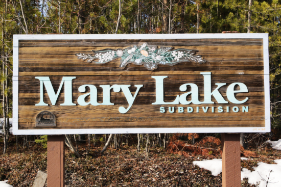
Mary Lake
Theme: Flowers
For much more information, see The history of the Mary Lake Country Residential subdivision.
- Aster Place: Several species of aster grow in the Yukon. A particularly interesting one is the Yukon aster (Symphyotrichum yukonense), which was first identified in 1945 and in the Yukon only grows in the Kluane Lake area.
- Bluebell Place: The Northern bluebell (Mertensia paniculata), also known as tall lungwort, is an herb or dwarf shrub with drooping bright-blue, bell-shaped flowers.
- Booth Road: The road to the Cadet Camp is the only road not named for a flower. Brian Booth was actively involved with the Air Cadet League of Canada, and was instrumental in the establishment of the camp as well as the establishment of a Yukon chapter of the St. John Ambulance Association. He died in Whitehorse in 1990.
- Buttercup Place: The Littleleaf buttercup (Ranunculus abortivus) grows across much of North America. Several other flowers in the Buttercup family also grow in the Yukon.
- Columbine Place: The delicate-appearing Western columbine (quilegia formosa) only grows along the southern edge of the Yukon.
- Crocus Place: The Prairie crocus (Anemone patens), also known as the pasque flower, is one of the most-loved of Yukon flowers, and photos of the first blooms to appear in April (in the Whitehorse area) are commonly posted on social media.
- Fireweed Drive: the road that circles the Mary Lake subdivision was named for the Yukon's territorial flower. The bright pink fireweed (Epilobium angustifolium) was chosen as Yukon's floral emblem on March 27, 1957.
- Iris Place: The only large iris that is native to the Yukon is the rare violet-coloured Beach-head Iris (Iris setosa).
- Larkspur Place: The Tall Larkspur (Delphinium glaucum) and the much less common Arctic Larkspur (Delphinium brachycentrum) both grow in the Yukon.
- Lupin Place: There are two species of lupine in the Yukon, the Yukon lupine (Lupinus kuschei) and the Arctic lupine (Lupinus arcticus). The two species are often found growing side-by-side.
- Marigold Place: The White marsh-marigold (Caltha leptosepala) and Yellow marsh-marigold (Caltha palustris) both grow in the Yukon, in wet, open areas in montane, subalpine and alpine regions.
- Orchid Place: In the Yukon, 17 species of tiny native orchids grow at various places, with Orchid Acres in West Dawson being particularly well-known for their profusion there. Species in the Whitehorse area include the Small Northern bog orchid (Platanthera obtusata) and Calypso orchid (Calypso bulbosa), also known as the Fairy slipper.
- Sage Place: Arctic sage (Artemisia frigida), also known as Pasture sage, has matted, woolly clumps of silvery green leaves, and blossoms briefly with small, pale yellow flowers in mid to late June.

Mount Sima Industrial
The Mount Sima Industrial area was opened in the Spring of 2002.
- Collins Lane: Collins Lane was named for Bob Collins, one of nine miners trapped in a cave-in at the Pueblo copper mine on March 21, 1917. His was one of six bodies which were never recovered. It becomes Moraine Drive when it continues into the Whitehorse Copper subdivision.
- Levich Drive: Levich Drive was named for B. Levich, one of nine miners trapped in a cave-in at the Pueblo copper mine on March 21, 1917. His was one of six bodies which were never recovered.
- McFadden Way: McFadden Way was named for T. M. McFadden, one of nine miners trapped in a cave-in at the Pueblo copper mine on March 21, 1917. His was one of six bodies which were never recovered.
- Mount Sima Road: Mount Sima Road was built as the access road to the Mount Sima ski hill, which opened in December 1992.
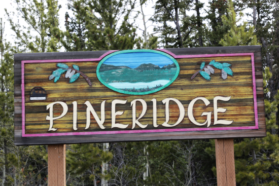
Pineridge
Theme: Mountains.
- Arkell Place: Mount Arkell, 1,893 metres high, is located west of Whitehorse, at 60° 35' 58" N., 135° 37' 14" W. Mount Arkell was named after A. J. Arkel, sponsor of the Frank Leslie Illustrated News expedition of 1890. Kusawa Lake was named Lake Arkel, but later reverted to Kusawa, its original First Nations name.
- Castle Drive: Castle Mountain, 1,556 metres high, is located north of Keno City, at 64° 31' 59" N., 135° 27' 15" W.
- Haldane Place: Mount Haldane, 1,589 metres high, is located north of Mayo, at 63° 51' 39" N., 135° 50' 30" W.
- Harvey Place: Mount Harvey, 973 metres high, is located at the head of Lindeman Lake, BC, at 59° 47' 58" N., 135° 6' 13" W. Mount Harvey was named in 1984 for Robert "Bruce" Harvey, Superintendent of Historic Sites for Parks Canada, who worked on the relocation of the S.S. Klondike and the creation of the Klondike Gold Rush International Historical Park.
- Harvey Road: Mount Harvey, 973 metres high, is located at the head of Lindeman Lake, BC, at 59° 47' 58" N., 135° 6' 13" W.
- Keele Place: Keele Peak, 2,972 metres high, is located northeast of Ross River, just north of Macmillan Pass, at 63° 25' 53" N., 130° 19' 27" W. The highest peak in the Mackenzie Mountains, it is considered to be one of Canada's most prominent peaks, with a prominence measure of 2,177 metres.
- Logan Road: Mount Logan, 5,959 metres high, is located in the southwest corner of the Yukon, at 60° 34' 4" N., 140° 24' 21" W. The highest mountain in Canada and the second-highest in North America, Mount Logan was named after geologist Sir William Edmond Logan, founder of the Geological Survey of Canada.
- Nansen Drive: Mount Nansen, 1,827 metres high, is located west of Carmacks, at 62° 6' 23" N., 137° 18' 29" W.
- Tombstone Place: Tombstone Mountain, 1,903 metres high, is located northeast of Dawson in Tombstone Territorial Park, at 64° 24' 19" N., 138° 40' 54" W. Tombstone Mountain was named for its distinctive shape when seen from the Dempster Highway.
Mountain View Drive sign
Porter Creek
When development began in what is now Porter Creek in 1956, it was known as Mile 921, then when land was surveyed and put up for sale by the federal government in the Spring of 1960, Porter Creek came into use.
Theme: Trees of the world. The Yukon's boreal forest is dominated by White spruce, Black spruce, Lodgepole pine, Trembling aspen, Balsam poplar, and Willow.
- 9th Avenue East
- 10th Avenue East
- 11th Avenue East
- 12th Avenue East: Porter Creek has four main streets - 12th Avenue East to the south, Centennial Street to west, Wann Road to north, and Hickory Street to the east.
- 13th Avenue East
- 14th Avenue East
- 15th Avenue East
- 15th Avenue West
- 17th Avenue East
- 17th Avenue West
- 20th Avenue East
- Alder Place: Alder is an early successional deciduous shrub or small tree. The most common alder species in the Yukon are Sitka alder (Alnus viridis) and Red alder (Alnus rubra).
- Alder Street: As above.
- Almond Place: The almond tree (Prunus dulcis) is native to southwestern Asia, but is now grown in many places around the world because of its valuable nuts.
- Aspen Place: Trembling aspen (Populus tremuloides) grows throughout much of the Yukon. All the trees in an aspen stand may be clones of a single tree. While they may all look like individual trees, they are all connected underground by their roots. The largest organism in the world is a clone stand of Trembling Aspen.
- Balsam Crescent: Balsam poplar (Populus balsamifera), common in the Yukon, are medium to large-sized hardwoods which often grow on river flood plains.
- Bamboo Crescent: There are more than 1,400 species of bamboo growing in tropical, subtropical, and mild temperate regions around the world.
- Basswood Street: Basswood (Tilia americana), commonly called American basswood or American linden, is native to eastern North America.
- Beech Street: There are 13 species of Beech trees (family Fagaceae), deciduous plants native to the eastern United States and southeastern Canada.
- Birch Road: Paper birch (Betula papyrifera) can be found in many Yukon locations, as it tolerates a wide range of rainfall and grows on almost any soil and topographic site.
- Birch Street: As above.
- Boxwood Crescent: Boxwood is a common name for the shrub Buxus, a genus of about 70 species in the family Buxaceae. It is one of the most popular evergreen shrubs for landscaping.
- Cedar Crescent: Both Western red cedar (Thuja plicata) and Yellow cedar (Callitropsis nootkatensis) can be found in the Pacific Maritime Ecozone of the southwestern corner of the Yukon.
- Centennial Street: Centennial Street, a commercial and residential street which runs parallel to the Alaska Highway, was named in 1967, Canada's centennial year.
- Chestnut Place: The American chestnut (Castanea dentata) is a large, fast-growing deciduous tree of the beech family native to the eastern United States and southwestern Ontario.
- Dogwood Street: There are over 50 species of dogwood, genus Cornus. The flower of the Western flowering dogwood (Cornus nuttallii) is the floral emblem of British Columbia.
- Ebony Place: Ebony is a dense black/brown hardwood, coming from several species in the genus Diospyros. It is often cited as one of the most expensive woods in the world.
- Elm Street: Elms are deciduous and semi-deciduous trees comprising the genus Ulmus in the family Ulmaceae. They are distributed over most of the Northern Hemisphere.
- Evergreen Crescent: The term "evergreen" refers to any plant that retains its leaves through the year - inn the Yukon, those are all conifers such as pine and fir.
- Fir Street: The Subalpine fir (Abies lasiocarpa) was selected as the Yukon's territorial tree in 2001. It is found in higher altitudes because it has a low tolerance to high temperatures.
- Gibbons Place: Gibbons Place is only about 80 meters long. First appearing in the newspaper in 1988, it appears to have been named for Charles Gibbons, owner of the property before it was subdivided.
- Grove Street: A grove is a group of trees growing close together.
- Hemlock Street: Hemlock is the common name for the genus Tsuga of conifers in the subfamily Abietoideae of Pinaceae, the pine family.
- Hickory Street: Hickory is a common name for trees composing the genus Carya, which includes around 18 species. The Shagbark hickory (Carya ovata) is native to Canada and the eastern United States.
- Holly Street: Holly, genus Ilex has over 570 species of flowering plants in a wide variety of forms, in the family Aquifoliaceae.
- Juniper Drive: Junipers are coniferous trees and shrubs in the genus Juniperus of the cypress family Cupressaceae, with over 50 species growing around the world.

Alaska Highway sign
- Larch Street: Tamarack larch (Larix laricina), common in the Yukon, is a small to medium-sized deciduous conifer which most commonly grows on wet to moist organic soils.
- Locust Place: Locust, genus Robinia in the family Fabaceae, is a group of flowering deciduous trees and shrubs native to North America.
- Lodgepole Lane: Lodgepole pine (Pinus contorta), common in the Yukon, is very adaptable, able to grown in a range of climates and soils but is typically found on moist soils.
- Maple Street: The are 132 species of maple trees and shrubs in the genus Acer growing around the world. Stylized versions of the maple leaf can be found on many official Canadian designs including the national flag.
- Mountain View Drive: Mountain View Drive becomes Hickory Street when it reaches the southern cross-street in Porter Creek, 12th Avenue East.
- Mulberry Place: Mulberry is the common name for Morus, a genus of flowering deciduous trees in the family Moraceae that can be found growing in many temperate regions around the world.
- Oak Street: An oak is a hardwood tree or shrub in the genus Quercus of the beech family. Widely distributed in the Northern Hemisphere (though not in the Yukon), it includes some 500 species, both deciduous and evergreen.
- Pine Street: Lodgepole pine (Pinus contorta), common in the Yukon, is very adaptable, able to grown in a range of climates and soils but is typically found on moist soils.
- Ponderosa Drive: The ponderosa pine (Pinus ponderosa), also known as bull pine, blackjack pine, western yellow-pine, or filipinus pine, is the most widely distributed pine species in North America.
- Redwood Street: Redwoods (Sequoioideae) are a subfamily of coniferous trees within the family Cupressaceae that includes the largest and tallest trees in the world.
- Rosewood Place: True rosewoods come from trees of the genus Dalbergia, but the name rosewood is often used for any richly hued hardwoods, often brownish with darker veining, but found in other colours.
- Spruce Street: The most common tree species found in Yukon forests is white spruce (Picea glauca). Black Spruce (Picea mariana) is the species best adapted to growth on permafrost because of its shallow roots.
- Stan McCowan Place: The street and arena were named for Stan McCowan, president of the Porter Creek Citizen's Association and active in the Board of Trade, the mining industry, and the United Church. He died in January 1967. The arena was renamed in 1976, and the new street was named in 2008 after the arena was demolished and plans were approved for residential development.
- Sycamore Street: American sycamore (Platanus occidentalis), also known as American planetree or western plane, is found primarily in the eastern and central United States, but the name sycamore is used for many other trees with similar leaves.
- Tamarack Drive: Tamarack larch (Larix laricina), common in the Yukon, is a small to medium-sized deciduous conifer which most commonly grows on wet to moist organic soils.
- Teak Avenue: Teak (Tectona grandis) is a tropical hardwood tree species in the family Lamiaceae.
- Versluce Place: In 1985, subdivision of an area known historically as Versluce Meadows for owner Peter Versluce was approved as a Country Residential Subdivision, and Versluce Place was built to access those acreage lots.
- Walnut Crescent: Walnut, (genus Juglans), includes about 20 species of deciduous trees of the family Juglandaceae, native to North and South America, southern Europe, Asia, and the West Indies.
- Wann Road: Wann Road was named for Clyde Guin Wann, one of the Yukon's most prolific business people. He arrived in the Yukon as a miner in 1927, started the first commercial aviation company, and went on to start a Chrysler dealership and build several Alaska Highway lodges.
- Willow Crescent: At least 30 species of willow are found in the Yukon, from the very common Net-leaved willow (Salix reticulata) and Grayleaf willow (Salix glauca) to the rare MacCalla's Willow (Salix maccalliana).
- Yew Place: Yews (genus Taxus) are a varied group of coniferous shrubs and trees that produce seed cones called yew berries.

Range Point
Theme: None apparent.
- Crow Street: Crow Street runs into First Nations land where there are several homes. The crow and wolf represent the two moiety clans of all 14 First Nations in the Yukon, including Kwanlin Dün and Ta'an Kwäch'än Council of the Whitehorse area.
- East View Place
- Mountainview Place North
- Mountainview Place South
- Range Road: Range Road was originally the access road to the low-frequency radio range to the north of the airport. This was the main navigation system used by aircraft for instrument flying in the 1930s and 1940s.
- River Ridge Lane
- Swan Drive: Swans are among the Yukon's most-loved birds, and thousands of Trumpeter swans (Cygnus buccinator) and much smaller numbers of Tundra swans
(Cygnus columbianus) pass through the Whitehorse area on their annual migrations. On rare occasions Whooper swans (Cygnus cygnus) have also been seen. Range Point is a particularly good area to see them flying up and down the valley.
- Vista View Place
- West View Place
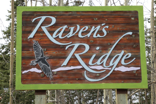
Raven's Ridge
Theme: Copper mines.
- Arctic Chief Place: The Arctic Chief copper claim was staked in 1899 by Captain John Irving, a steamboat captain who also spent a lot of time with mining investments. The first ore was shipped in 1904, but work was sporadic until 1909 when it was closed. It became an open pit mine in the late 1960s but the ore was soon exhausted.
- War Eagle Way: The War Eagle copper claim was staked by Sam McGee on July 16, 1899, but the first major development work didn't take place until 1907. In the late 1960s it became an open pit mine, and in the 1980s, long after it had been mined out, the City of Whitehorse used it as a garbage pit for a few years.

Riverdale
Primary theme: Rivers.
- Aishihik Road: The Aishihik River, also known as Canyon Creek, flows south from Aishihik Lake, at 61° 28' N., 137° 13' W. It is a tributary of the Dezadeash River, part of the Alsek River watershed. Aishihik is an English version of the Southern Tutchone name, Äshèyi, the village "at the head of the lake." Otter Falls, located on the Aishihik River, were pictured on the reverse of the 1954 series of Canadian $5 bills.
- Alsek Road: The Alsek River starts at the confluence of the Dezadeash and Kaskawulsh Rivers at 60° 39' N., 137° 49' W., and flows into the Gulf of Alaska at Dry Bay.
- Bates Crescent: The Bates River flows from Bates Lake at 60° 15' N., 137° 36' W., and flows into the Alsek River.
- Bell Crescent: The Bell River flows generally west from near the Yukon/NWT border, into the Porcupine River 150 km above Old Crow. Paddlers can reach a tributary, the Little Bell River, by flying to Summit Lake at 67° 42' N., 136° 28' W. The Bell River was named for Chief Trader John Bell of the Hudson's Bay Company, who visited the area in 1846.
- Blanchard Road: The Blanchard River, with headwaters in the Haines Summit area, is a tributary of the Tatshenshini River, which flows into the Alsek River. It was named for federal surveyor G. Blanchard Dodge, a member of the BC-Yukon boundary survey team in 1908.
- Bonanza Place: Bonanza Creek, a tributary of the Klondike River, is the primary creek through the Klondike gold fields, and was the site of the discovery of gold on August 16, 1896. Prior to that discovery it had been called Rabbit Creek.
- Boswell Crescent: The Boswell River is a tributary of the Teslin River, with headwaters at Mount Murphy, which is at 61° 00' N., 133° 36' W., west of Quiet Lake. The Boswell River was named for brothers Thomas and George Boswell, the first prospectors on the Teslin River.
- Chadburn Lake Road: Chadburn Lake is near the southeast corner of the City of Whitehorse, with road access at at 60° 39' 15" N., 134° 58' 14" W. Chadburn Lake was named after Spitfire fighter ace Wing Commander Lloyd Vernon Chadburn, DSO, DFC, who died of wounds suffered in action on June 13, 1944.
- Donjek Road: The Donjek River, a tributary of the White River, flows from glaciers on the eastern side of the Saint Elias Mountains, including the Donjek Glacier at 61° 12' N., 139° 33' W. The name refers to the white berries (silverberries) which grow along the river - in Northern Tutchone the berry is called dän jäk.
- Duke Road: The Duke River, a tributary of the Kluane River, flows from glaciers on the eastern side of the Saint Elias Mountains. It joins the Kluane at 61° 26' 24" N., 139° 06' 20" W. In 1905, the Duke River was named for George Duke, one of the earliest prospectors in the area.
- Firth Road: The headwaters of the Firth River are in the British Mountains, in what is now Ivvavik National Park. It empties into the Beaufort Sea jjust west of Hershel Island, at 69° 33' N., 139° 30' W. In 1890, the Mountain Indian River was renamed for John Firth, Hudson's Bay Company agent at Rampart House.
- Green Crescent: The Green River flows into the Hyland River northeast of Watson Lake, at 60° 37' 06" N., 128° 10' 53" W.
- Grey Mountain Road: This road climbs Grey Mountain to a communications tower.
- Hart Crescent: With headwaters in the Wernecke Mountains at about 65° 09 N., 137° 09' W., the Hart River flows north and east to the Peel River. It may have been named for Howard Hamilton Hart, a prospector who came to the Yukon in 1884.
- Hospital Road: This short road runs from Lewes Boulevard to the Whitehorse General Hospital.
- Hyland Crescent: The Hyland River, with headwaters near the Yukon-NWT border north-north-east of Frances Lake, flows south across the Yukon-BC border at 60° N., 128° 10' 40" W. east of Lower Post, then empties into the Liard River.
- Ibex Street: The headwaters of the Ibex River are at the northwestern base of Ibex Mountain, a young volcanic cinder cone located at 60° 31' N., 135° 29' W., 33 km southwest of Whitehorse. It flows north and west and empties into the Takhini River.
- Kalzas Place: The Kalzas River flows out of Big Kalzas Lake at 63° 12' N., 134° 46' W., southeast of Mayo, then flows southwest to empty into the Macmillan River, a major tributary of the Pelly River.
- Ketza Road: The headwaters of the Ketza River are southeast of Ross River. It flows north, crossing the Robert Campbell Highway at 61° 51' N., 132° 19' W. before emptying into the Pelly River.
- Klondike Road: The headwaters of the Klondike River are in the Ogilvie Mountains northeast of Dawson City and it flows into the Yukon River at Dawson City. Its name comes from the Hän word trondek, meaning hammerstone, a tool which was used to hammer down stakes used to set salmon nets. Although it gave its name to the Klondike Gold Rush, very little gold was found on the Klondike River, the majority coming from tributary creeks to the south of the mouth.
- Kluhini Crescent: Often confused with the Klehini River on the BC-Alaska border, the Kluhini River flows west from the western slopes of Kluhini Peak at 60° 25' N., 136° 32' W., emptying into Dezadeash Lake.
- Koidern Avenue: With headwaters at the glaciers around 61° 45' N., 140° 19' W., the Koidern River flows northeast then northwest, through the maze of lakes west of Pickhandle Lake, crossing the Alaska Highway at at 61° 58' N., 140° 25' W. before finally emptying into the White River.
- Lewes Boulevard: The name Lewes River applied to various sections of the upper Yukon River, generally upstream of Lake Laberge, but sometimes further. On May 5, 1949, the Geographic Board of Canada officially changed the name of those sections from Lewes River to Yukon River, but even today Lewes is sometimes used. See "The Lewes River" by Darrell Hookey for a detailed look at the issue.
- Liard Road: The headwaters of the Liard River are in the south-eastern Yukon, on the slopes of Mount Lewis at 61° 14' N., 131° 38' W. It flows southeast into BC, then northeast to empty into the Mackenzie River at Fort Simpson, NWT. It is named for the liards (poplar trees) that grow along it.
- McQuesten Road: The McQuesten River is formed by the North McQuesten River and South McQuesten River, whose headwaters are in the eastern Ogilvie Mountains. It flows generally southwest before emptying into the Stewart River at 63° 33' N., 137° 27' W.
- Morley Road: The Morley River flows west and then northwest from Morley Lake at 60° 00' N., 132° 07' W. to Teslin Lake. It was named after surveyor Morley Ogilvie, son of William Ogilvie.
- Nisutlin Drive: The Nisutlin River begins as the McNeil River in the Pelly Mountains of south-central Yukon, flows northwest then southwest, then as the Nisultin flows southeast and south to empty into the Teslin Lake at Teslin.
- Peel Road: The headwaters of the Peel River are in the Ogilvie Mountains northeast of Dawson City. It flows generally north to partially empty into the Mackenzie River north of Fort McPherson, NWT - the Peel Channel continues north to empty into the Beaufort Sea.
- Pelly Road The headwaters of the Pelly River are in the Pelly Mountains near the Yukon-NWT border northeast of Ross River. It was named for Sir John Henry Pelly (1777-1852), 17th Governor of the Hudson's Bay Company. It empties in the Yukon River at 62° 47' N., 137° 20' W., near Fort Selkirk.
- Primrose Road: The headwaters of the Primrose River are at the glaciers west of Mount Foster, which is right on the BC-Alaska border at 59° 48' N., 135° 29' W. The waters flow through Silt Lake and Primrose Lake, where Primrose River proper starts. It flows north through Rose Lake and eventually west to empty into Kusawa Lake right at the foot where the Takhini River begins.
- Ross Road: The headwaters of the Ross River are in the Mackenzie Mountains, along the Yukon-NWT border north of Mount Wilson at 62° 53' N., 129° 42' W. It joins the Pelly River at the community of Ross River. It was named after Donald Ross, a chief factor of the Hudson's Bay Company.
- Selkirk Street: Selkirk Creek begins west of Minto between Apex Mountain and Prospector Mountain, at about 62° 29' N., 137° 54' W. It flows generally northwest and empties into the Yukon River at Selwyn. It is highly possible, however, that Selkirk Street was named for Fort Selkirk, originally a Hudson's Bay Company post on the Yukon River, as that is what Selkirk School was stated to be named for when it opened in 1959.
- Stewart Road: A major tributary of the Yukon River, the Stewart River is formed by two main branches that drain a vast area along the Yukon-NWT border. It flows generally west and empties in the Yukon River after some 500 kilometers, at 63° 18' N., 139° 25' W.
- Tagish Road: The Tagish River, also known as the Six Mile River, flows from Tagish Lake into Marsh Lake.
- Takhini Avenue: The Takhini River flows from Kusawa Lake at 60° 36' N., 136° 07' W., and empties into the Yukon River at Hidden Valley, the northernmost subdivision of Whitehorse.
- Tatchun Road: Tatchun Creek is a small stream which flows approximately 5 kilometers from Tatchun Lake to the Yukon River at 62° 17' N., 136° 19' W., downstream from Five Finger Rapids.
- Tay Street: The Tay River begins at Tay Lake in the Pelly Mountains at 62° 22' N., 132° 08' W., and flows generally west to empty into the Pelly River northeast of Glenlyon Peak, approximately 70 km downstream from Faro.
- Teslin Road: The headwaters of the Teslin River are in BC at 58° 59' N., 131° 15' W., from where it flows northwest into Teslin Lake and continues to empty into the Yukon River at Hootalinqua, downstream from Lake Laberge.
- Tummel Road: The Tummel River is a tributary of the Pelly River, flowing from the south and meeting the Pelly at 62° 45' N., 135° 03' W.
- Tutshi Road: The Tutshi River begins in the maze of lakes and ponds north of Fraser, BC, and flows into Tutshi Lake at 59° 49' N., 134° 48' W. From the end of 35-km-long Tutshi Lake the river flows another 5 km into Tagish Lake.
- Van Gorda Place: Van Gorda is a mis-spelling of Van Gorder Creek, which flows around the communityn of Faro from the east, emptying into the Pelly River just upstream from the bridge, at 62° 13' N., 133° 22' W.
- Wickstrom Road: Wickstrom Road was originally a trail to Dawson and Livingstone Creek, and was later upgraded to a wood-cutting road by Olof "Ole" Wickstrom. In 1966, Helen and Bill Horback, who lived on the road, named it for him and the name was accepted.

Spruce Hill
Theme: Spruce tree species
- Engelmann Drive: Engelmann Drive was named for the Engelmann spruce (Picea engelmannii), which was named for German botanist Theodor Engelmann (1843-1909). Engelmann spruce commonly occurs with subalpine fir in areas with long, cold winters and short, cool summers, or in drier areas, with lodgepole pine.
- Sitka Crescent: Sitka Crescent was named for the Sitka spruce (Picea sitchensis), which grows in a band down the west coast of North America from Alaska to northern California. The consistently straight, fine, even-textured grain has made it a favourite for everything from furniture to light aircraft construction.
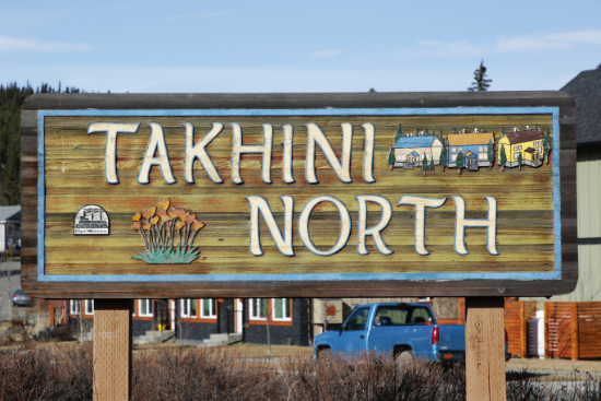
Takhini
Theme: Canadian battles during World Wars I and II.
- Antwerp Street: From October 2 until 8 November 1944, the Battle of the Scheldt was fought to free the port of Antwerp.
- Arnhem Road: The Battle of Arnhem was fought in and around the Dutch city of Arnhem from September 17-26, 1944.
- Carpiquet Road: Operation Windsor, part of the Battle of Normandy, was fought on July 4-5, 1944, to take the French village of Carpiquet and the adjacent airfield.
- Cassino Street: In 1944, Cassino was a key point in the German winter defensive line (Garigliano-Sangro) blocking the Allied advance to Rome. In ground fighting and bombing from January until May, the Allied forces did break through.
- Falaise Place: On June 7, 1944, Allied forces bombed the town of Falaise for the first time in an air attack aimed at slowing the advance of German reinforcements towards the landing beaches.
- Falaise Road: The battle of the Falaise pocket from August 12-21, 1944, was the decisive engagement of the Battle of Normandy. Allied forces formed a pocket around Falaise in which German Army Group B, consisting of the 7th Army and the Fifth Panzer Army, were encircled by the Western Allies.
- Mons Road: The Battle of Mons on August 23, 1914, was the first major action of the British Expeditionary Force (BEF) in the First World War. With twice as many men and guns, the Germans forced the BEF into a retreat and it was not until the second Battle of Mons on November 11, 1918, that the town was taken.
- Mountain View Drive
- Nijmegan Road: The Battle of Nijmegen occurred September 17-20, 1944, as part of Operation Market Garden. American troops captured both bridges across the Waal River, vital for the Allied advance towards Arnhem.
- Normandy Road: The Normandy landings in Operation Overlord on June 6, 1944, often referred to as D-Day, was the largest seaborne invasion in history, with 7,000 ships and landing craft manned by over 195,000 naval personnel from eight allied countries.
- Normandy Road North: By June 11, 1944, the beaches at Normandy were fully secured and over 326,000 troops, more than 50,000 vehicles and some 100,000 tons of equipment had been landed. More than 4,000 Allied troops lost their lives in the D-Day invasion, with thousands more wounded or missing.
- Ortona Avenue: The Battle of Ortona, fought from December 20-28, 1943, by Canadian and German forces was one of the most important events of the Italian campaign.
- Range Road: Range Road was originally the access road to the low-frequency radio range to the north of the airport. This was the main navigation system used by aircraft for instrument flying in the 1930s and 1940s.
- Rhine Way: The crucial crossing of the Rhine River in Operation Plunder on March 23-27, 1945, allowed American and British troops to advance into the interior of Germany.
- Seine Square: Crossing the Seine River involved a series of battles during August 1944.
- University Drive: Formerly College Drive, this is the road to Yukon University, which was Yukon College until May 19, 2020.
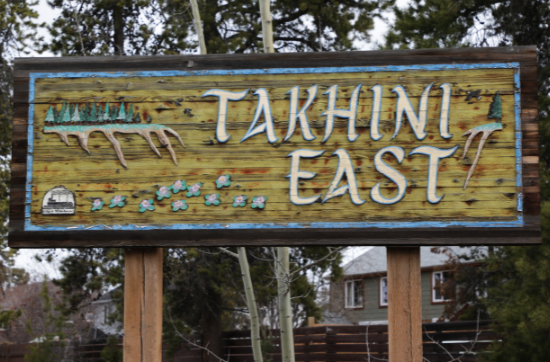
- Arleux Place: On April 28, 1917, four Canadian battalions launched at attack on the Arleux Loop, part of an intricate system of German defenses that were intermingled with the village of Arleux-en-Gohelle.
- Cambrai Place: The Second Battle of Cambrai in northern France took place from September 27 to October 11, 1918. More than 30,000 Canadians were killed or wounded.
- Dieppe Drive: The Raid on Dieppe, Operation Jubilee, was a disastrous Allied amphibious attack on the German-occupied port of Dieppe in northern France just before dawn on August 19, 1942. It was a disaster - more than 900 Canadian soldiers were killed, and thousands more were wounded and/or taken prisoner.
- Vimy Place: The Battle of Vimy Ridge on April 9-12, 1917, was part of the Battle of Arras in France. Four divisions of the Canadian Corps in the First Army fought three divisions of the German 6th Army. Today, the Canadian National Vimy Memorial, built
as a tribute to all Canadians who served during the First World War, stands on the site.
Taylor Industrial
- MacDonald Road: Named in January 1970 for Holly MacDonald (1919-1969), a considerable force in Pelly Crossing, Porter Creek, and the Scottish community of Whitehorse from 1958 until 1969. The name was initially given to the entire industrial area.
- Poplar Road: Balsam poplar (Populus balsamifera), also known as cottonwood

Valleyview
- Sumanik Drive: Named in December 1982 for Don Sumanik, president of the Territorial Experimental Ski Training (TEST) program starting in 1970, when he and Father J. M. Mouchet led the building of many miles of cross-country ski trails behind Valleyview.
- Valleyview Crescent
- Valleyview Drive
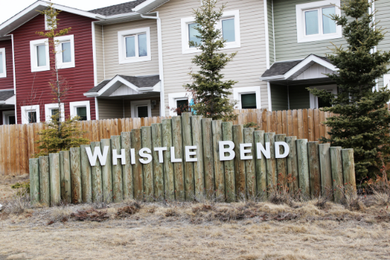
Whistle Bend
Theme and name: Sternwheelers and other riverboats. During the gold rush, steamboats navigating the bends on the Yukon River below the Whistle Bend area used to blow their whistles to alert other ships of their presence.
This section of the page is in addition to a more detailed listing we began in January 2019, "Street name origins in the Whistle Bend community."
- Aksala Drive: The Aksala was a wooden sternwheeler, 164.8 feet long, built in Whitehorse in 1913 as the Alaska, by British Yukon Navigation crews for a newly-formed WP&YR division, the American Navigation Company. For much more information, see our page about the Aksala.
- Alert Avenue: The Alert was a wooden sternwheeler, 34.0 feet long, built at Lake Lindeman in 1898 by Edwin Van Wart, for John McKenna of Lake Bennett. She probably sank in Lake Bennett in 1900.
- Atlin Place: The Atlin is a 58-foot-long barge that was built at Atlin in 1903, to be used by the steamer Scotia. In February 1974, it was trucked to Whitehorse and set up on the riverfront with the S.S. Klondike.
- Aurora Drive: The Aurora was a small wooden sternwheeler, about 35 feet long with canvas sides. She was used by the Canada-Alaska Boundary Survey in 1910-1912.
- Bailey Place: The Bailey was a wooden sternwheeler, 110.0 feet long, built at Lake Bennett in 1899 by Louis Pacquet of Portland, for Captains Steve Bailey and Irwin B. Sanburn. She was used briefly in 1904, then was put up on the ways at Whitehorse, and was demolished in 1931. For much more information, see our page about the Bailey.
- Bellingham Court: The Bellingham was a wooden sternwheeler, 35 feet long, built at Whatcom, near Bellingham, in 1897, by Lenn Springer, for Dignan, Stinger & Willock of New Whatcom. She was dismantled and shipped to Skagway on the barkm Theobold, then skidded over the White Pass at a cost of $2,000 and reassembled at Lake Bennett. In June 1898 she was run through Miles Canyon by pilot M. L. Foster, for $200. She was towing a scow (for $1100) carrying most of the staff, cash, safes and other equipment to open two branches of the Canadian Bank of Commerce at Dawson, one Uptown, one on First Avenue.
- Breadwinner Lane: The Breadwinner was a steel hulled propeller steamer, 45 feet long, built at Seattle in 1899 by James Casey, for a prospecting company comprised of W. S. Stratton, W. A. Otis, James Casey and 2 other men. In June 1899 the Breadwinner arrived at Dawson with the company's sternwheeler, the W. S. Stratton.
- Caprice Court: The Caprice was a small screw propeller launch. Little is known about her, but she was operating on the Stewart River at Mayo in about 1924-25.
- Casca Boulevard: The were three wooden sternwheelers named Casca on the Yukon River. The first Casca was built in 1898 - in 1911, described in company records as being "practically worn out and useless ...", she was rebuilt so extensively that she was considered to be a new boat. The second Casca was wrecked at Rink Rapids on July 9, 1936. The third Casca, 180 feet long, was built at Vancouver and Whitehorse over the winter of 1936-1937; she and the Whitehorse were burned on June 21, 1974, with the cause never determined. For much more information, see our page about the Casca No. 3.
- Chakawana Lane: The Chakawana II was an RCMP propeller launch based at Old Crow in the late 1920s and '30s. She was built inn about 1928 at Fort Yukon, Alaska, at the suggestion of Cst. Arthur Thornthwaite; it was designed with a propeller whose height was adjustable by a hand crank. It was named after a police launch that Thornthwaite had used in Prince Rupert in 1920.
- Chance Lane: Nothing is known about the Chance beyond the facts that she was built in Dawson in about 1907, had a catamaran hull and was probably propeller driven.
- Dora Crescent: The Dora was a wooden sternwheeler, 60.0 feet long. She was built in 1898 at Bennett, but there is no agreement on the details, or even on the original name of the boat. She was built by Albert S. Kerry for his own use, but soon after she was built, the Bennett Lake & Klondyke Navigation Company was operating her. They bought her in August 1899, changed the name to Dora, then soon changed the name again, to Olive May. In 1908 she sank in the Thirty Mile River and was broken up. Her hull again wrecked in the Thirty Mile in May 1909, and of the 312 head of sheep on board, 105 were lost by being drowned. The hull was then abandoned.
- Eldorado Drive: The Eldorado was wooden sternwheeler, 140.3 feet long, built in Seattle in 1898 by the San Francisco Bridge Company, for the Boston & Alaska Transportation Company. She was named the Philip B. Low and was towed to St. Michael by the Laurada. Operating on the upper river run, she sank so many times she was nicknamed the "Fillup Below", so the name was soon changed to Eldorado. She was dismantled at Dawson in 1903, with the hull possibly used as a barge.
- Ellwood Street: The Ellwood was a wooden sternwheeler, 154 feet long, built at Portland in 1891 for Abernethy & Company. She was taken tom the Stikine River in 1898, but was soon laid up at Wrangell. In January 1903 she was sold to Captain H. B. MacDonald of Seattle, who took her to Puget Sound.
- Eugene Avenue: The Eugene was a wooden sternwheeler, 163.0 feet long, built at Portland by Captain F. C. Jones, for the Willamette River Navigation Company, to be used as a ferry on the Willamette River. In August 1897 she was being towed from Portland to St. Michael with 25 passengers on board but was so unseaworthy the passengers mutinied at Queen Charlotte Sound. The Eugene turned back under her own power, and made it back to Portland.
- Evelyn Avenue: The Evelyn was a wooden sternwheeler, 130 feet long, built at Seattle in 1908 by Bratnober, for the Upper Tanana Trading Company, but sold to the North American Trading & Transportation Company. She was moved to the upper Yukon in 1913 and renamed the Norcom but didn't work regularly and by 1918 was on the ways at Shipyard Island, Hootalinqua, where she remains today.
- Flora Avenue: The Flora was a wooden sternwheeler, 79.5 feet long, built at Lake Bennett in 1898 by Bert Fowler, for the Bennett Lake & Klondyke Navigation Co., Otto Partridge, manager. She was wrecked in the ice in 1902, the hull was used as a barge by by the Five Fingers Coal Company, then in 1905 it was used to build a dredge. For much more information, see our page about the Flora.
- Fulton Lane: The Fulton was a wooden sternwheeler, 65 feet long, built at St. Michael in 1898.
- Gleaner Avenue: The Gleaner was a wooden sternwheeler, 113.0 feet long, built at Lake Bennett in 1899 by the John Irving Navigation Company Ltd. She was in regular use until 1917, then sporadically for at least another eight years. She was eventually scuttled in Nares Lake, probably to act as a wingdam to channel the water through the lake for the Tutshi, which ran until 1955, the wreckage of the Gleaner is still visible at extreme low water. For much more information, see our page about the Gleaner.
- Goddard Way: The A. J. Goddard was a wooden/iron/steel sternwheeler, 50 feet long. Her hull was built at San Francisco in 1897, and the boat was assembled and completed at Lake Bennett by James H. Calvert over the winter of 1897-1898, for the Upper Yukon Company Ltd., owned by A. J. Goddard. She worked for only four years before sinking in a storm on Lake Laberge. In 2008 the wreck of the boat was discovered. The intact state of the vessel and its cargo provides an extraordinary link to the past, and Yukon Heritage has published a 38-page brochure about it - see "The Wreck of the A.J. Goddard".
- Hope Street: Little is known about the Hope. She was a wooden sternwheeler, built at Victoria in 1861 and in 1875 was working on the Stikine River for Captain John Irving. In 1882 her engines and boiler were removed and the was boat taken to Wrangell to serve as a floating boarding house
- Iditarod Lane: Little is known about the Iditarod. She was a wooden sternwheeler, built in about 1909, and ran between Fairbanks and Iditarod under Captain Slippern.
- Iskoot Crescent: The Iskoot was a wooden sternwheeler, 143 feet long, built at Vancouver in 1898 by B.C. Iron Works, for the Klondyke Mining, Trading & Transport Company. In June 1898 she was wrecked while being delivered to the Stikine River; her machinery was removed and returned to Victoria to be used in another boat.
- Keno Way: The Keno was a wooden sternwheeler, 130.5 feet long, designed and built at Whitehorse in 1922 by British Yukon Navigation Company construction foreman A. E. Henderson. She was retired in 1951, and in August 1960, made the last sternwheeler run in the territory, to her final resting place at Dawson, where she is on display. For much more information, see our page about the Keno.
- Leota Street: The Leota was a wooden sternwheeler, 50.5 feet long, built at Alameda, California, in 1898 for the California-Alaska Mining and Transport Company, as a tender for the sternwheeler Dawson City. She was taken to the Yukon River knocked down, on the deck of the Dawson City. On May 25, 1920, she stranded near Fairbanks and was abandoned.
- Luella Lane: The Luella was a wooden sternwheeler, 65.0 feet long, built at Stockton, California, in 1898 for the Alaska Commercial Company; completed on the Koyukuk River. She operated between Fairbanks and the Koyukuk River until at least 1910, and was eventually abandoned at Koyukuk.
- Marathon Way: The configuration of the Marathon is uncertain, though she was probably a sternwheeler. On September 14, 1909, she passed by Tanana enroute to Iditarod, under Captain Olsen. We have no further information about her.
- Mascot Street: The existence of the Mascot has never been confirmed. In June 1898, the British American Line claimed that she and 4 other river steamers would connect at St. Michael with their steamer Garonne. The Mascotte, however, did exist - she was a wooden sternwheeler, 130 feet long, built at Puget Sound in 1898 for the Klondike-Chicago Transportation & Trading Company.
- Neecheah Street: The Neecheah was a wooden propeller launch, originally 63.5 feet long. She was built at Whitehorse in 1920 as the Kestrel, one of the first gasoline-powered boats in the territory. In 1922 she was renamed Neecheah and rebuilt to 78.5 feet long. In 1997, she was acquired by the Yukon Transportation Museum, where she is on display. For much more information, see our page about the Neecheah.
- Olive May Way: The Olive May was a wooden sternwheeler, 60.0 feet long. She was built in 1898 at Bennett, but there is no agreement on the details, or even on the original name of the boat. She was built by Albert S. Kerry for his own use, but soon after she was built, the Bennett Lake & Klondyke Navigation Company was operating her. They bought her in August 1899, changed the name to Dora, then soon changed the name again, to Olive May. In 1908 she sank in the Thirty Mile River and was broken up. Her hull again wrecked in the Thirty Mile in May 1909, and of the 312 head of sheep on board, 105 were lost by being drowned. The hull was then abandoned.
- Omega Street: Originally Peep Street, but changed in February 2022. The Omega was a wooden hull, propeller steam scow, 129 feet long, built at Bennett, under the direction of Mike Heney, for the White Pass & Yukon Route. Used to haul freight along Lake Bennett during the railway's construction period, she was so fast she was nicknamed "The Torpedo Chaser." It's not known what happened to her, but she was removed from the Shipping Registry in 1920.
- Quick Street: The Quick was a wooden sternwheeler, 60.0 feet long, built at Dawson in 1900 by E. J. Smythe, for Robert C. Smith, with steel sheathing over frames from the Burpee. She may have been used as the Dawson ferry for a while, and was abandoned at Dawson in about 1915.
- Rampart Avenue: The Rampart was a wooden sternwheeler, 42.8 feet long, built at Dawson in 1908 by Alphonse Geoffrey, for Dan Cadzow. She was destroyed in 1914.
- Reliance Street: The Reliance was a wooden sternwheeler, 120 feet long, built at St. Michael in 1907 for the Northern Navigation Company. In 1927 she was sold to the Alaska Railroad but they never sued her and she was abandoned at the Chena shipyards.
- Sadie Lane: The Sadie was a steel-hulled side paddlewheeler, 120 feet long. She was built at San Francisco in 1898 by the Union Iron Works, for the Alaska Commercial Company. Initially used a a harbor tug, she was reconfigured and used as a mail boat until being wrecked when she struck an uncharted rock off Cape York in September 1904.
- Scotia Lane: Originally Gypsy Queen Lane, but changed in February 2022. The Scotia was a wooden sternwheeler, 80.0 feet long. She was built at Chicago in 1899, knocked down for transport to St. Michael, and that Spring assembled at Taku for the John Irving Navigation Company. She worked Atlin Lake until 1918, and was burned as a hazard in 1967. For much more information, see our page about the Scotia.
- Skookum Drive: This is the only street in Whistle Bend that does not have a boat name. This road was built some 20 years earlier, to access the Mountain View Golf Course, and in 1996-97 Skookum Asphalt donated the paving for it, as well as paving most of the cart paths on the course itself, and the parking lot.
- Sybil Circle: The Sybil was a wooden sternwheeler, 101 feet long, built of B.C. fir at Victoria in 1898 by James C. Stratford. In 1899 she was one of seven steamers operated on the lower Yukon River by the British American Steamship Company. That summer, she was chartered by the Canadian Development Company, and moved to the upper river. In 1901, under new owner the British Yukon Navigation Company, she was lengthened to 167 feet long, but in June 1904 all of her machinery was removed and the hull was used for a few years as a barge.
- Tanana Lane: The Tanana was a wooden sternwheeler, 149.6 feet long. the "swift and finely built craft" was built at Portland in 1904 by Joseph Supple, and assembled at St. Michael by the Northern Navigation Company, for the Fairbanks trade. She quickly became one of Fairbanks' most liked steamers and worked until 1921, when she hit a snag and sank in the Tanana River.
- Tarahne Way: The Tarahne was originally 78.2 feet long, designed and built at Atlin in 1917 by British Yukon Navigation Company (BYN) construction foreman A. E. Henderson, with materials hauled over the ice from Carcross. She was powered by two gasoline engines and was driven by two propellers. In 1928, due to a booming tourist business, she was cut in two, the halves pulled apart, and 41 feet were added in the middle. The Depression killed the Atlin tourist trade, and in 1936 the Tarahne was retired. She remains on display at Atlin. For much more information, see our page about the Tarahne.
- Tyrell Crescent: The Tyrrell was a steel and wood sternwheeler, 142 feet long, built at Vancouver in 1898 by J. M. Bulger, for the Canadian Pacific Steam Navigation Company. She was built for service on the Stikine River, but never worked there. She is believed to have been named for Joseph Burr Tyrrell, famous Canadian Arctic explorer and geologist - note that the street name is spelled incorrectly. The Tyrrell was abandoned in the slough down river from Dawson now known as the "Sternwheeler Graveyard". For much more information, see our page about the Tyrrell.
- Vedder Avenue: The Vedder was a wooden sternwheeler, 75 feet long, built at New Westminster in 1909 to work as Fraser River ferry. In May 1914 she was sent to Wrangell to work on the Stikine River but only made one trip, then in June 1914 she was destroyed by fire at Wrangell.
- Whistle Bend Way: Whistle Bend Way is the primary access street into the community.
- Witch Hazel Drive: The Witch Hazel was a propeller steamer, 27 feet long. She was built at Bridal Veil, Oregon, in the Spring of 1895, then hauled over the Chilkoot Pass with block and tackle by Frank Atkins and E. L. Bushnell. She was launched at Lake Bennett and run to Fortymile, becoming the first steamer through Miles Canyon. At Fortymile she was stripped of her machinery and some wood, and abandoned.
- Wyvern Avenue: The Wyvern was a wooden sternwheeler, 45 feet long. She was built in Dartmouth, England, in 1896, with a hull of teak and mahogany; owned by Edward M. Bruce. Shipped to Alaska, she was wrecked on the Snake River in July 1900.
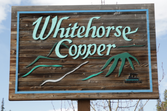
Whitehorse Copper
Theme: Glacial and ice features.
- Cirque Place: Cirque Place is named for a cirque, a bowl-shaped, amphitheater-like depression that a glacier has carved into a mountain or valley sidewall at high elevations.
- Crevasse Court: Crevasse Court is named for a crevasse, a large, deep crack in a glacier. They may be hidden by snow, and make travel across a glacier very hazardous.
- Drumlin Crescent: Drumlin Crescent is named for a drumlin, a hill of sediment, generally elongated, formed by glacier flow. They often occur together in fields, sometimes hundreds of them.
- Esker Drive: Esker Drive is named for an esker, a ridge made of sand and gravel that was deposited by glacial meltwater flowing through tunnels within and underneath glaciers, or through meltwater channels on top of glaciers. Eskers often make good road surfaces through boggy areas.
- Kame Court: Kame Court is named for a kame, a mound of sand and gravel deposted by water as a glacier retreats. Kames are sometimes used as denning locations by wolves and other animals.
- Kettle Lake Place: Kettle Lake Place is named for a kettle lake or simply kettle, formed when a block of stagnant ice (a serac) detaches from a glacier. Eventually it becomes wholly or partially buried in sediment and slowly melts, leaving behind a pit. If water fills the depression, a kettle lake is the result.
- Moraine Drive: Moraine Drive is named for a moraine, material left behind by a moving glacier. A terminal moraine is at the foot of a glacier, lateral moraine along the sides, a medial moraine between two glaciers, and a supraglacial moraine on the surface of a glacier. It becomes Collins Lane when it continues into the Mount Sima Industrial area.
- Nunatak Place: Nunatak Place is named for a nunatak, a hill or mountain completely surrounded by glacial ice. If the nunatak is rounded because the glacier once flowed over it, it is sometimes called a rognon.
- Pingo Place: Pingo Place is named for a pingo, a dome-shaped hill formed in a permafrost area by the pressure of freezing groundwater pushing up a layer of frozen ground. In the area around Tuktoyaktuk, Northwest Territories, there are some 1,350 pingos. The Pingo Canadian Landmark protects 8 of them, including Ibyuk Pingo, Canada's tallest and the world's second-tallest pingo, at 49 metres in height.
- Serac Court: Serac Court is named for a serac, a free-standing block or column of glacial ice, often formed by intersecting crevasses, or by "dry calving."
- Talus Drive: Talus Drive is named for talus, a slope made of a jumble of rocks that have fallen from a rocky cliff or other rock face above. Scree is formed in the sale way but consists of small rocks that are generally less stable than talus.
- Tarn Court: Tarn Court is named for a tarn, a small mountain lake which is set in a glaciated steep-walled amphitheatre known as a cirque.
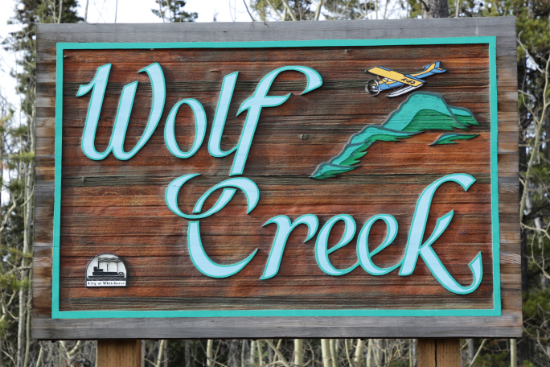
Wolf Creek
Initially called the Sowden subdivision, it was re-named Wolf Creek in August 1977.
Theme: Significant Yukoners.
- Boss Road: Boss Road was named for Jim Boss (Kashxóot), hereditary chief of the Ta'an Kwäch'än from about 1900 until his death in 1950. In 1900-02, he successfully lobbied the federal government to set aside land for his people - the first land claim in the territory.
- Cronkhite Road: Cronkhite Road was named for H. H. Cronkhite, who served with the Royal Canadian Mounted Police in Whitehorse as Corporal in the 1920s, as Sergeant at Dawson in the 1930s, and as Inspector back at Whitehorse from 1943-1948.
- Dawson Road: Dawson Road was named for George Dawson (K'Alazhaw). Among his many accomplishments, he worked on the riverboats Kluane, Selkirk, Dawson, Casca and Aksala, and recruited and led an all-First Nations crew during the construction of the Alaska Highway in the 1940s. In 1976 he was recognized for being a charter member (with Jim Boss) of the Chief Mundessa Club, which renovated five First Nations cemeteries. He was recognized as Pioneer of the Year by the Yukon Transportation Hall of Fame in 2022.
- Harbottle Road: Harbottle Road was named for the Harbottle family. Francis Edmund "Bud" Harbottle (1915-1990), born and raised in Whitehorse, with an extensive list of accomplishments in aviation. His second wife, Jeanne, was the first white woman in the territory to acquire a trapper's licence and a big game guide licence. His father, also Francis Edmund, arrived in the Yukon with the Royal Northwest Mounted Police in 1901, and Mount Harbottle is named after him.
- Langholz Road: Langholz Road was named for Fred Langholz, who was very visible in Whitehorse as a partner in the Langholz and Neilsen freighting company starting in 1905, running a wood-cutting company to supply the steamboats, serving as an officer in the Moose Lodge, operating a fox farm, and playing in the town band.
- Phelps Place: Phelps Place, only a couple of hundred meters long, was named for the Phelps family. Willard "Deacon" Phelps, a prominent lawyer for some 40 years as well as serving on the first wholly elected Yukon Council. He was also a partner in a freighting business and helped his son and son-in-law start Yukon Electrical.
- Ryder Place: Ryder Place was named after the Ryder family - Roland, who arrived in 1900; son George and his wife Edith; and children Lloyd, Audrey, Gordon, and Howard. Their combined accomplishments in everything from water delivery to aviation and community service would take a book to describe.
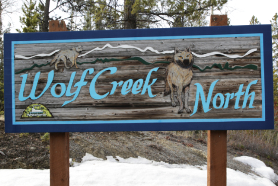
- Blaker Place: In November 2000, this new street (the only street in Wolf Creek North) was named to honour the city's first employee, Fred Blaker, who started as Fire Chief on October 18, 1950.
Yukon Gardens
- Garden Road: Garden Road was named for Yukon Gardens.
- Metropolit Lane: Metropolit Lane, constructed in 2008, was named for Lorne and Jean Metropolit, who owned the property.
Other Areas
(not officially recognized as communities)
The community (which is the Lobird Mobile Home Park, opened in 1970) and the primary street were named for Birdetta "Birdie" Staley - she and her husband John owned the property. "Gramma Birdie" died in 2021.
- Copper Haul Road
- Mount Sima Road
- 2 Mile Road
- Alaska Highway (Highway 1)
- Ear Lake Road
- Fish Lake Road
- Fox Farm Road
- Ice Lake Road
- Klondike Highway (Highway 2)
- Long Lake Road
- McGundy Road: This section of the Old Alaska Highway was named in September 2014 for the McGundy family, Kwanlin Dun First Nations members who moved there soon after the highway was built.
- McLean Creek Lane
- McLean Lake Road: The name McLean (or McLean's) Lake first appeared in the newspaper in 1944, and McLean Lake Road in 1969, but we haven't found a source of the name yet.
- Parent Lane: Named in 2003 at the request of Joan Parent, whose family had lived on the unnamed rural road at about Mile 926.3 of the Alaska Highway for 27 years.
- Robert Service Way: Robert Service Way, which was initially called the South Access, was named for poet Robert W. Service in 1995. We have posted a very detailed history of Robert Service Way.
- Squatters Road
- Stevens: The 43-lot Stevens country residential subdivision, to be located on the north side of the Alaska Highway, five kilometers west of the Klondike Highway, was proposed in 1992 but cancelled in 1994 after strong opposition by area residents. It was going to be named for Norval Leroy "Red" Stevens, an area rancher and horsemen who arrived from Wyoming in 1960.
- Two Mile Hill Road
|

|
