By CAPT. RICHARD L. NEUBERGER.
In September, 1942, a group of us reporting for duty with the United States Army in the Far North, were riding along the steep shores of Lake Bennett on a
puffing little train of the narrow gauge White Pass and Yukon Railway.
The old day coach swayed rhythimically as we rounded a sharp curve; it dated from the era of the Klondikers. A high camel-backed stove was at each end of the car.
Suddenty a lieutenant of Engineers pointed to a rocky island just off shore. "What's that sign?" he asked.
We looked. On the pile of basalt outcroppings that formed the island stood a sign with the legend "B.C.-Y.T." In large letters.
A soldier conductor of the 770th Military Railway Battalion came through the car. "That marks the boundary between British Columbia and the Yukon Territory," he explained in answer to our question about the sign.
We looked again. We had travelled nearly 1000 miles since leaving Vancouver's imposing waterfront. We were a full 150 miles north of Juneau, the capital of
Alaska. We were more than 400 miles above Ketchikan, the seaport which is Alaska's coastal gateway. We were even north of Sitka, the Alaskan capital in the days when those hardy northerners, the Russians, owned the great peninsular rampart of the North Pacific.
Yet we had just crossed the northern edge of British Columbia. None of us had realized how far north Canada's vast western province extended. We were two long days' journey by steamship beyond the southern tip of Alaska, we had reached the 6Oth parallel, and yet still the land was British Columbia.
A quartermaster major on our train came from Texas. "By gosh," he admitied, "British Columbia is even bigger than Texas." For a Texan this is the ultimate
in concessions. Our officers and enlisted men from the largest state in the American Union are always astonished to learn that although Texas composes 265,896 square miles, British Columbia tops this figure by 100,000 square miles; 366,255. To any U.S. soldier a geographic entity 100,000 square miles larger than Texas is a measureless place indeed.
But astonishment over British Columbia‘s long reach is not confined to us who are guests in Canada. On a recent visit to Vancouver and Victoria with Brig.-Gen.
James A. O'Connor, I was asked many times if I found the Yukon winters excruciatingly cold and bitter.
My invariable reply was: "Well, you people who are residents of British Columbia should be just about as familiar with these winters as I am. After all, you know,
our headquarters at Whitehorse are only 60 miles north of the northern boundary of your own province."
This statement inevitably led to a hasty search for maps. Looking at these maps, life-tong inhabitants of British Columbia's metropolls, Vancouver, and her capital, Victoria, were amazed to discover that their province ended a bare 60 miles south
of the Yukon transportation centre of Whitehorse, where the U.S. Army's Northwest Service Command has its main headquarters and where navigation on the immense Yukon River system begins, a navigation route which ends at St. Michael on the Bering Sea, 2000 miles away.
American soldiers who have come to Canada to collaborate in the defense of the continent are thoroughly familiar with British Columbia's northernmost settlement of Bennett. To them Bennett symbolizes one of the great triumvirate of "eats, mail and girls." In the case of Bennett it is eats.

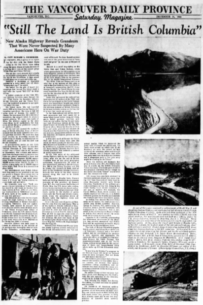
As one of the major constructive achievements of World War II, will stand the Alaskan Highway, not much short of half of which is built through British Columbian territory. Quite a bit less than one-fourth of the 1630 miles lies in Alaska of the U.S. As a wartime necessity of North American Allied strategy, the now-famous road was built as a military project by U.S. Army engineers, headed by Brig.-Gen. James A. O'Connor. These photographs give some idea of the scenery and terrain throvgh which the highway passes. First, along the rim of quiet beauty of Muncho Lake, in the B.C. uplands, the highest point of the international highway, about 4000 feet above sea level.
Bennett is a small way-station on the White Pass and Yukon Railway, which
winds spectacularly for 111 mountain miles from Skagway, Alaska, to Whitehorse. This thread of narrow-gauge steel has been one of the main supply links in the construction of the Alaska International Highway.
The White Pass and Yukon route is so vital that in the autumn of 1942, after a visit to the Far North by Lieut.-Gen. Brehon B. Somervell, commanding the U.S. Army Service Forces, the United States Government leased the line from its British owners for the duration of the war and one year thereafter.
Under this agreement the railroad has been operated by soldiers of the 770th, and the army has shipped up the Inside Passage many new locomotives, freight cars, rotary snowplows and similar equipment. Bennett, the northern outpost of British Columbia, is the most welcome station on the line, for it in here that meals are served.
In the high-raftered old station house both passengers and train crews eat a menu which never varies - soup, pot roast, gravy, boiled potatoes, macaroni, jam
tarts, pie and coffee. During the past summer such illustrious visitors as the Governor-General of Canada ond his wife, the Princess Alice; Mayor La Guardia of New
York, and many generals and admirals of Canada and the United States, and numerous Senators, congressmen and members of the Canadian Parliament partook of this standard meal.
A few miles north of Bennett the White Pass and Yukon tracks twist past the island on which stands the boundary sign. Both Bennett and Lake Bennett were named
by Al Schwatka, a pioneer Alaska surveyor, for James Gordon Bennett, the New York Herald publisher, who financed a number of Arctic explorations.
Of the 1630 miles of the celebrated Alaska Highway bullt by the United States Army, more are on the soil of British Columbia than of any other geographic
subdivision. Approximately 780 miles of the international road are in British Columbia, 500 in the Yukon Territory and 350 in Alaska. Col. Kenneth B. Bush, chief of staff of the Northwest Service Command, believes that some of the most majestic scenery along the road is in British Columbia.
He nominates Muncho Lake, Summit Lake and Folding Mountain as conspicuous
examples of this grandeur, At Summit Lake, B.C. the road crosses the Continental Divide. Here the U.S. Army relay station, where trucks and buses are fueled and repaired, and drivers and passengers get their meals, nestles in the shadow of peaks which split the Pacific and Atlantic watersheds. Along the precipitous shores of Muncho Lake the highway winds and curves like a hoop.
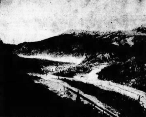
Summit Lake relay station of U.S. Army along the Alaskan Highway in the B.C. mountains, At this point the road crosses the divide separating the Atlantic and Pacific watershed systems. (Photos by Gail Pinkstaff, U.S. Public Roads Administration.)
It is in the east central portion of British Columbia that the road begins. This is at the northern Alberta rallhead of Dawson Creek. The main points on the road are Fort St. John and Fort Nelson. Gen. O'Connor arrived at Fort St. John in early
May of 1942 to supervise construction of the southern half of the highway. Under his direction the road was thrust as far as Watson Lake. From Watson Lake northward, Brig.-Gen. William M. Hoge managed the far-flung job.
Between Fort Nelson and Watson Lake the Alaska Highway crosses and recrosses the British Columbia-Yukon line. "On our survey parties when we pioneered the
road," Gen. O'Connor has pointed out, "we never were certain on which side of the boundary we were. We picked the best routes up the mountain passes and through river canyons, and I imagine that often one party was working in British Columbia and a companion party a few rods away might be standing in the Yukon."
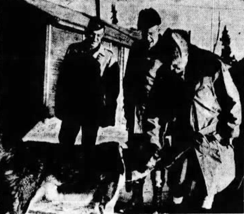
At an Alaskan Highway relay station along the B.C.northern boundary, the highway's builder, Brigadier O'Connor, greets a husky visitor. Left to right, Lieut. Philip Aster of Cleveland, Ohio; Capt. Richard L, Neuberger, A.D.C. to Brigadier O'Connor and author of this article, and Brigadier O'Connor. (Photo by Sgt. Conrad Puhr, U.S. Army.)
Near the historic old Hudson's Bay store at Lower Post, B.C., the Alaska Highway is exactly on the British Columbia-Yukon boundary, This is the point at which the proposed road from Prince George up the Rocky Mountain "trench" would intersect the international road.
U.S. troops have now been stationed in Canada's northland almost two years. During that time thousands of them have become thoroughly familiar with British
Columbia. Practically all the military projects undertaken by the U.S. Army in the
North Pacific touch British Columbia at one spot or another. For example, the Haines Military Road, which connects the Alaska Highway with the sea, is on British Columbia ground for 45 miles as it ascends the Chilkoot and Three Guardsmen passes.
At Dalton Post, historic Mounted Police camp on the border, the road passes from Alaska Into British Columbia. Maj.-Gen. George R. Pearkes, V.C., commanding the Canadian Army's Pacific Command, with headquarters at Vancouver, was a constable in the old Northwest Mounted Police at Dalton Post shortly before his enlistment for overseas service in 1914.
Inspector H. H. Cronkhite, commanding the Whitehorse detachment of the Mounties, has recently announced that Dalton Post will be reactivated as traffic begins to move on the Haines Military Road.
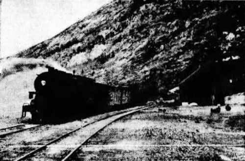
Bennett, B.C., a White Pass & Yukon train, operated by U.S, soldiers, stops on its journey from Skagway to Whitehorse. (U.S, Signal Corps photo.)
The bulk of British Columbia's population is concentrated along its southern rim - in Vancouver, Victoria, and a few other centres. But the northland of the province is vast, majestic and impressive. No American officer or enlisted man has travelled through the Inside Passage, that mountain-barricaded arm of the Pacific Ocean, without being awed by the succession of fiords and forest-rimmed inlets which make up British Columbia's coastline.
"I was born in Norway," a sergeant in the Medical Corps told me as we watched from an army transport, "but our fiords can not match this beauty."
The northern rivers have had a fascination for our soldiers for two widely divergent reasons; (1) because they contain superlative fishing possibilities, and (2) because they have imposed the major construction difficulties in the building of the
Alaska Highway.
No soldier learns without surprise that every great river flowing into the Pacific, with the sole exception of the Colorado, originates in British Columbia.
This includes the Fraser, the Skeena, the Stikine, the Liard and even the ponderous Columbia.
On thousands of American soldiers British Columbia has made a profound impression. All of them await the hour when they can return again to their homes, but
with equal fervor they promise to bring their families some day to see the magnificence of Canada's most westerly province.