Hiking Middle Ridge, Tutshi Lake, BC
Arctic & Northern Mining
Dateline: August 24, 2026.
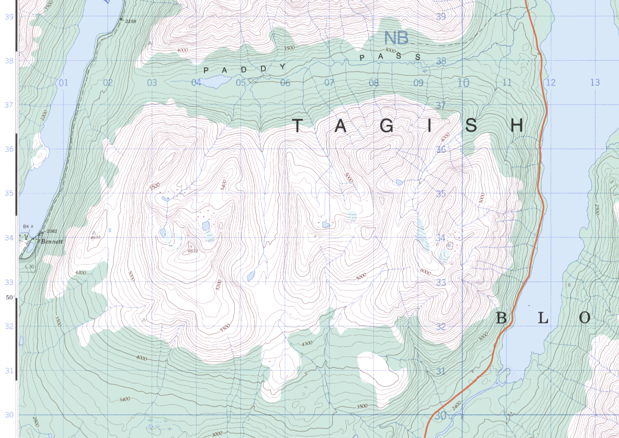
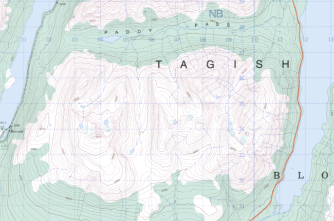
The north-eastern corner of a block of mountains between Tutshi Lake and Lake Bennett has seen sporadic mining exploration work for 120 years, and an ATV trail provides enticing access to the area from the South Klondike Highway. No geographic feature in the entire block has been named, so we are using the name "Middle Ridge" as is used in some BC mining reports. The topographic map (104 M/15, 1:50,000) shows the block - click on it to greatly enlarge it in a new window. Also see GeoBC map 104M086, 1:20,000.
Many of the mountains along the various routes to the Klondike gold fields were explored and tested by people who thought their chances of getting rich might be better elsewhere. Four shallow adits on Middle Ridge may date back to that period.
From 1950 to 1954, Robert L. "Bob" Christie mapped the area for the
Geological Survey of Canada (See Christie, 1957). The area was also mapped by Bultman (1979) in his thesis on the Whitehorse Trough. In 1985, Schroeter examined mineral properties within the Bennett map area (Schroeter, 1986). During 1986 reconnaissance mapping and prospecting was
carried out by H. Copland (1987). Regional mapping of the Tutshi Lake area was performed by the British Columbia Geological Survey in 1987 (Mihalynuk and Rouse, 1988a, 1988b; Rouse et al, 1988). In 1988, reconnaissance mapping and prospecting was carried out by Beacon Hill Consultants Ltd. (Morris, 1988).
The first detailed documented exploration of Middle Ridge seems to have been done by Frame Mining in 1988 and 1989, and the lower part of the ATV trail may have been built then. Frame had acquired their Catfish claims over North and South Mountains and Middle Ridge in 1988. In 1988, Frame mapped the property, re-discovered three old adits on Middle Ridge and described a zone of quartz-arsenopyrite veining (now termed the Tannis Zone) with up to 47.3 grams of gold per tonne, which could be traced for 2.5 kilometres. Frame's 1989 program focused on Middle Ridge, with trenching confirming the gold-bearing nature of the Tannis Zone quartz-arsenopyrite veins. An induced polarization (IP) survey showed moderate to strong chargeability anomalies over the known veins and a large, complex zone of unexplained moderate to strong chargeability on the south slopes of Paddy Pass Creek, in an area of little outcrop. See the 135-page Geology of the Catfish Mineral Property (J. H. Davis, 1989). Trenches seen today along that section of the trail may be the 8 trenches Frame reported hand-digging that year. Although gold and silver values were reported, no further work was done by Frame.
The Catfish claims lapsed, were restaked as the Tutshi Lake property and a short VLF-EM survey was run in 1997 over Paddy Pass Creek, between Middle Ridge and North Mountain, without any significant results.
The most recent claims on Middle Ridge, the Tannis claims, were staked in 2001 and 2002. In 2002 Marksmen Resources Ltd. conducted an exploration program consisting of geological mapping, rock sampling and IP geophysical surveying on the ridge. See the 82-page report by Franz Dziuba, 2002.
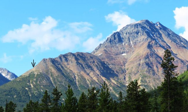
The next photo shows Middle Ridge and the unnamed peak that some mining reports called South Mountain. The arrow points to the end of the ATV trail.
On October 2, 2007, geologist Scott Casselman published a 119-page report on the previous year's exploration work on the Golden Eagle property by Troymet Exploration Corp. (a spin-off company of Marksmen Resources Ltd.). Part of that work was on Middle Ridge (the Tannis Block), consisting of construction of an ATV trail, detailed geological mapping, rock sampling, and diamond drilling. The program was conducted in stages, with the ATV trail construction commencing on May 25, followed by the geological mapping and sampling and drill pad construction in June through early July. The diamond drilling, which Caron Diamond Drilling commenced on September 6 and was completed on November 30, confirmed the presence of high-grade gold mineralization in quartz-arsenopyrite. Only the one hole (TAN06-04) was completed before the onset of severe winter weather conditions necessitated the drill rig being moved to a safer location.
Casselman includes a great list of crew members:
The 2006 exploration program on the property consisted of construction of an ATV access trail on Middle Ridge, detailed geological mapping on Middle Ridge, and 1,125 m of diamond drilling in 6 holes.
Aurora Geosciences Ltd of Whitehorse was contracted to conduct the field program. The ATV trail construction was conducted from May 25 to June 19 and from July 7 to 15 and was accomplished with the use of a small Kubota backhoe. The crew consisted of Gary Lee (supervisor), Gord Uttley (labourer), Gaetan Cyr (labourer), Jesse Halle (geologist) and Bob Stirling of Stewart Basin Exploration (backhoe owner/operator).
The geological mapping and sampling program on Middle Ridge was conducted from June 20 to 30 and was accomplished by Jesse Halle (geologist) and Lauren Blackburn (geologist). Drill pad blasting and construction was conducted from July 21 to August 4 and from August 18 to 31 by Gary Lee (Crew supervisor and blaster), Gord Ruby (labourer) and Shawn Parent (labourer), Sabastian Roy (labourer) and Steve Francis (labourer).
The drilling program commenced on September 6 and continued to November 30. The Aurora Crew consisted of Scott Casselman (Project Manager), Kel Sax (Project Geologist), Lauren Blackburn (Geologist), Allison Peel (Geologist), Sharon Monder (Cook), Remy Legace (Labourer), Casey Adshead (geological technician), Maxim Dubois (labourer) and Michael Mark (core cutter). The drill contractor was Caron Diamond Drilling of Whitehorse, Yukon.
The next photo shows the ATV trail at about 1,250 meters elevation.
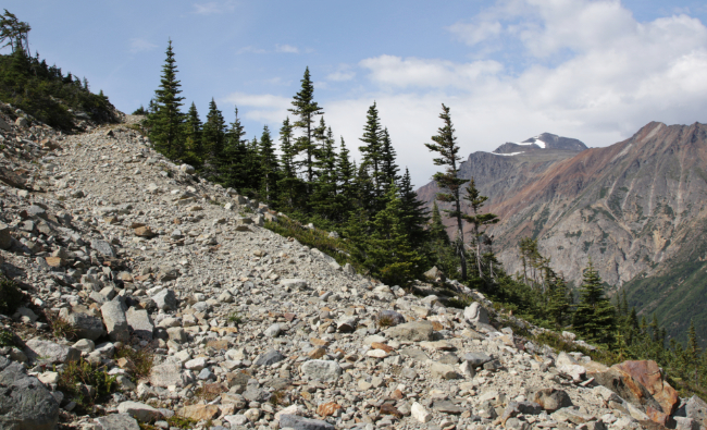
Troymet's 2008 exploration program consisted of diamond drilling on the Tannis Zone and geologic mapping and prospecting on North Mountain, Middle Ridge and South Mountain. Mapping and prospecting further defined the distribution of rock units and quartz-sulphide veining along a northwest trend nearly 5 km in length and resulted in the collection of 124 rock samples. Drilling in 2008 expanded upon previous drill holes in the Tannis zone that were directed solely at quartz-sulphide veins within rhyolite and rhyolite breccia to now include similar veins within equigranular biotite granite and the Boundary Ranges Metamorphic Suite. Twelve diamond drill holes totalling 2306 metres were completed.
The 2008 program was the final one on the Tannis Zone (Middle Ridge). In 2009, 2020, and 2011, other areas of the property were explored further with IP surveys and drilling.
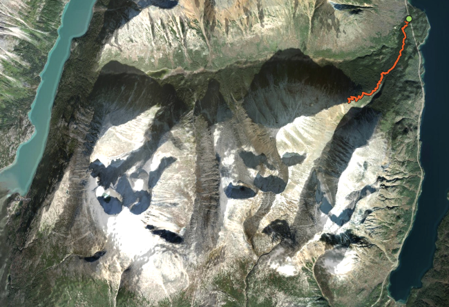
Our Strava page maps the 9-km hike from the highway to the end of the ATV trail and back. I actually climbed a bit above the end of the trail, to 1,357 meters/4,452 feet. Click on the image below to open that page in a new window.