
|





|
|
The Pacific-Yukon Highway to Alaska, 1933
An Explorer's Guide to the Alaska Highway ("Alcan")
There were several attempts to get a road built to Alaska before the attack on Pearl Harbor made it a military priority. The article that follows, from the La Grande Observer of September 27, 1933, gives a glimpse at one of those attempts, named the Pacific-Yukon Highway. This syndicated article appeared in newspapers across North America at that time. Note that the article spells the name of Alaska's delegate to Congress, Anthony J. Dimond, incorrectly.
Despite the coverage this syndicated article got, a short piece in the Washington Post 4 days prior foretold what the result of the highway promotion would be: "The two governments may not now be ready to make such a costly investment, but some day the road doubtless will be built."
See our Alaska Highway Chronology for more important dates in opening up the region and providing access to Alaska.
WASHINGTON (AP) - Proponents of the Pacific-Yukon highway, the proposed 2,000 mile road linking Alaska and the United States, are pressing for governmental approval of the project that would make more accessible one of America's "last frontiers."
Anthony J. Diamond, delegate to congress from Alaska, has asked the public works administration for an allotment of $2,000,000 to finance the Alaskan section of the highway. Diamond is also seeking President Roosevelt's approval of the project, which has been recommended as feasible by the United States commissioners appointed to co-operate with Canadian representatives in studying the plan.
Advocates of the highway say it would open to motorists a new scenic wonderland, to farm settlers rich acres in areas hitherto inaccessible and to miners an opportunity to develop one of the richest mineral storehouses on the North American continent.
The American members of the commission report that the advantages to be derived from a highway extending from Seattle to Fairbanks "are obviously more than commensurate with the cost."
They also say it would foster air commerce with Alaska by furnishing a guiding landmark and by providing service to aviators along the most practicable flying route to the interior of the territory and to Asia.
Thousands of motorists in quest of the new and picturesque in touring territory would travel the Alaskan road every year, it is believed.
Surveys place the highway to the east of the coast mountain range, where climatic conditions are such that snowfall is comparatively light, and if traffic ustified the road could be kept open the year round.
The estimated cost of constructing the Canadian section of the highway is $11,990,000 while that of the Alaska section is figured at only $1,970.000.
The map of the route seen below was published in the Fairbanks Daily News-Miner of October 5, 1933. It roughly follows the routes of what would become Interstate 5 to Vancouver, BC Highway 97 to Prince George, Highway 16 to Hazelton, the Stewart-Cassiar Highway to a point south of Dease Lake where it crosses to Atlin (on the map as "Alton"), the Atlin Road and Alaska Highway to Whitehorse, the North Klondike Highway to Dawson, and the Top of the World, Taylor, Alaska, and Richardson Highways to Fairbanks.

Although the above syndicated article had appeared in the Fairbanks Daily News-Miner of October 5, 1933, it didn't become front-page news until December 5.
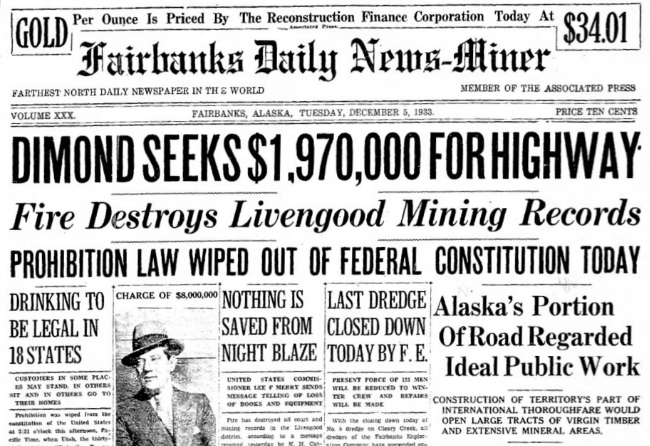
This article includes information that is of more local interest, corrects errors in the AP article previously published, and responds to the reluctance of Canada to build their section.
WASHINGTON, Dec. 5 - Describing the project as an ideal enterprise for the Public Works Administration, Anthony J. Dimond, Delegate in Congress from Alaska, announced today that he would seek an appropriation of $1,970,000 at the coming session of Congress, which meets in January.
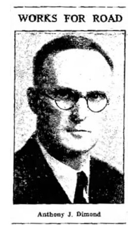 "Much of the work on the 174 miles of the highway to be constructed in Alaska would be hand work," Delegate Dimond said. "A great portion of the appropriation, namely $1,600,000, would go for day labor; the remainder for bridges, culverts and engineering.
Usefulness Is Emphasized
The usefulness of the Alaska section in no way depends on the Canadian portion of the Highway, as the Alaska section will open up thousands of acres of rich virgin timber lands and creek mining areas hitherto scarcely touched.
Under plans favored at present, the Alaska portion of the Highway would be 24 feet wide with a 16-foot gravel surface.
Would Prove Incentive
Delegate Dimond declared that he believed construction of the Alaska section would be an incentive to the construction of the Canadian portion, the cost of which is estimated at almost $11,000,000.
In the above Associated Press dispatch, the uncompleted Alaska section of the Highway is stated to be 174 miles. According to the report of the special commissioners appointed by President Hoover to study the project the uncompleted Alaska portion of the Highway is 183 miles, and the cost of construction for this mileage is estimated at $2,000.000.
Statement As To Cost
The Associated Press dispatch says the estimated cost of the Canadian portion of the Highway is "almost $11,000,000." According to the report of the special commissioners, the cost of the Canadian portion would be $12,000,000.
The total length of the highway - Seattle to Fairbanks - as reported by the special commissioners would be 2,256 miles. Of this length, 1,073 are completed and 1,183 uncompleted.
Uncompleted Portions
Of the uncompleted portion 1,000 miles are in Canadian territory, between Hazelton, B.C. and the Alaska Boundary, and 183 miles in Alaska between the Alaska Boundary and Fairbanks.
The special commissioners were Herbert H. Rice of Detroit, chairman Ernest Walker Sawyer, former assistant to the Secretary of the Interior, and Major Malcolm Elliott, Corps of Engineers, United States Army, former president of the Alaska Road Commission.
At the same time that many people were promoting the Pacific-Yukon Highway from Seattle to Fairbanks, others with an even grander vision were promoting the Midnight Sun Highway, from Alaska to Mexico. A brief article in The Pittsburgh Press of November 25, 1933, stated that boosters of the project "are overjoyed at the news the U. S. government will spend $18,000,000 in building a modern highway from Alaska to the Pacific Coast highway system. The new highway will be 850 miles long of which 440 miles are in British Columbia, 200 miles in Yukon and 210 miles in Alaska. It will give motorists a 4,000-mile run - from Alaska to Mexico."
Other routes were being discussed by other groups, too. A brief article in The Salt Lake Tribune of October 15, 1933, talked about a "proposed Alaskan-Canadian highway" that would link Alaska with the Peace River and Lesser Slave Lake regions. "Travel from this district to Edmonton, Great Falls, Mont., and Salt Lake City, Utah, would be over the Sunshine trail route." The Sunshine Trail had just been surfaced between Edmonton and Great Falls.
|

|
